Paths Greenways Bridleways Tracks
 PG: OBJECTS: PROMOTION: Abbots Langley 40 BW
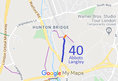
Map showing Abbots Langley 40 bridleway
Annotated map reproduced courtesy of Googlemaps.
This route runs from Gypsy Lane (public road section) north of the railway, over the railway then following the old road alignment to a junction with Watford Road.

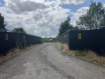
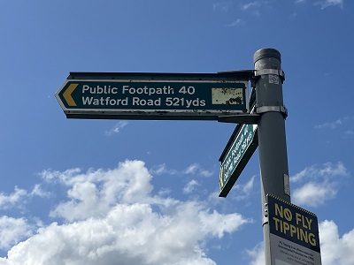
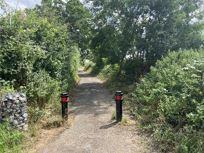
At the time of the 2023 Access Survey (9 Jul 23), there were pairs of ballards at each end presenting no difficulty to horse riders, cyclists or walkers. The signage at each end related to the status before teh route was legally upgraded to bridleway and so needs correction.
Photograph of Abbots Langley 40
Looking SW over railway bridge
Photo: Helen Taylor, 9 Jul 2023
Photograph of Abbots Langley 40
Sign just S of railway bridge
Photo: Helen Taylor, 9 Jul 2023
Photograph of Abbots Langley 40
Continuing southwards
Photo: Helen Taylor, 9 Jul 2023
Photograph of Abbots Langley 40
Continuing southwards
Photo: Helen Taylor, 9 Jul 2023
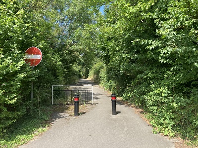
Photograph of Abbots Langley 40
Looking northwards from A41
Photo: Helen Taylor, 9 Jul 2023
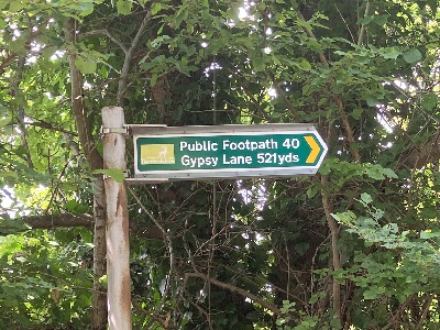
Photograph of Abbots Langley 40
Sign at A41 junction
Photo: Helen Taylor, 9 Jul 2023
BHS PGBT As part of the British Horse Society's work to record paths before Path Extinguishment Day, it was spotted that Gypsy Lane was only recorded as a footpath despite the historical evidence clearly indicating it had been a vehicular highway. Enquiries of the county council revealed that it had been stopped up reserving footpath rights. However, the council agreed a public path creation agreement with the landowner, so upgrading the path to bridleway. This left a very short section of Lane still recorded as footpath, and so an application was made for byway status for that section so that the bridleway would not become a cul-de-sac in 2026. This is a good example of the need for applications to record even very short sections of path lest the rest be made inaccessible by the Countryside and Rights of Way Act 2000's path-cancelling provisions.

Legal History
26 Feb 1976: The Three Rivers District Council applied to the Magistrates for a order stooping up the road (Gypsy Lane) reserving bridleway rights. The Court, on hearing an objection from a landowner, ordered that the route be stopped up reserving only footpath rights.
31 Dec 1977: The route was shown as a footpath on the special review draft map and statement. DM sheets SR-75 and SR-83.
10 Mar 2017: The Gypsy Lane Creation Agreement 2017 upgraded most of Abbots Langley 40 footpath to bridleway. HCC reference 3R/38. HCC Notice.
9 Jun 2017: The Hertfordshire County Council (Abbots Langley 40) Legal Event Modification Order 2017
25 Aug 2017: Application to record the short remaining section of Abbots Langley 40 Footpath that is on the line of Gypsy Lane (but in different ownership) as a byway. HCC reference 3R/100.
10 Jul 2023: Incorrect 'footpath' signs reported to Hertfordshire County Council, reference 401003538809.
Definitive Statement (4 Dec 2015)
Path: [Abbots Langley] 40.  Status: Bridleway.  Definitive Map sheets: 75, 83
Commences as FP from Old Mill Road S of The Maltings thence E for 170 feet thence S for 50 feet thence E for 85 feet thence SE and E to Gypsy Lane. Continues as BR from TL 0858 0019 and runs S for approx 465m to join Watford Road just N of the A405 interchange at TQ 0855 9973.
Width: Varies between 3m and 10m between TL 0858 0019 and TQ 0855 9973 as shown in the Gypsy Lane Creation Agreement 2017.
Limitations: None between TL 0858 0019 and TQ 0855 9973.

© 2023 Patchetts Green Bridleways Trust. File reference: EC847. HCC reference: 3R/100.