Paths Greenways Bridleways Tracks
 PG: OBJECTS: PROMOTION: Abbots Langley 45, Kings Langley 1A and Sarratt 69, 64A, 65 and 57 BW
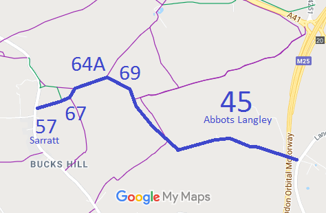
Map showing Abbots Langley 45 and others Annotated map reproduced courtesy of Googlemaps. This route starts at the public road, south of Calliper Hall, and heads eastwards to a junction with Sarratt 75 bridleway, then generally northeastwards before turning southeastwards to the corner of Berrybushes Wood. It continues generally southeastwards to Langleybury.

It may look like whoever recorded this path over-did it somewhat with the path number allocations! However, this is a consequence of the route crossing two parish boundaries followed by a movement of one of the boundaries.

We need a volunteer to photograph this route for this year's Access and Riding Rights of Way Survey. It's easy - just take photographs (safely) when you use the path. Find out more! (We still need Abbots Langley 45, Sarratt 69, 64A and 67, ideally starting at the eastern end heading west.)
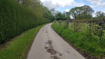
Sarratt 57 Sarratt 57: Looking W from Sarratt 75 BW
Photo: Phil Wadey, 16 May 2021
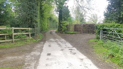
Sarratt 57 Sarratt 57: Heading West
Photo: Phil Wadey, 16 May 2021
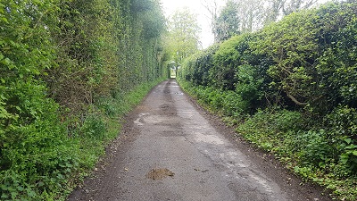
Sarratt 57 Sarratt 57: Heading West
Photo: Phil Wadey, 16 May 2021
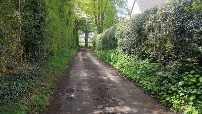
Sarratt 57 Sarratt 57: Approaching W road junction
Photo: Phil Wadey, 16 May 2021
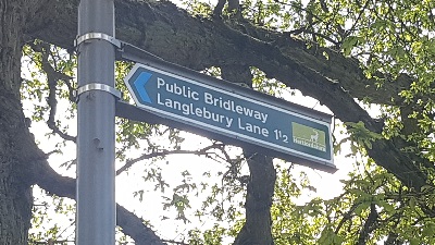
Sarratt 57 Sign Sarratt 57: Sign at western end
Photo: Phil Wadey, 16 May 2021

Legal History
20 Jun 1953: The route was recorded as a mixture of CRF, bridleway and footpath on the original definitive map and statement. DM sheet DM3-29.
31 Dec 1977: The route was shown as a bridleway on the special review draft map and statement. DM sheet SR-75.
1983: The M25 Motorway (Micklefield Green to South Mimms Section) and Connecting Roads Side Roads Order 1983 sets out an improvement to part of Abbots Langley 45 CRF. Schedule 2 refers. A length of 76m is coincident with private vehicular means of access.
25 Feb 2024: Overgrowth of Abbots Langley 45 sign at eastern end reported to HCC, reference 401003990255.
Definitive Statement (4 Dec 2015)
Path: [Abbots Langley] 45.  Status: Bridleway.  Definitive Map sheet: 75
Commences at parish boundary at NW corner of Berrybushes Wood thence SE along western boundary of wood to NW tip of Hawk Spring thence generally E to south of Model Farm across Sheepcote Spring to county road opposite Home Farm.

Path: [Sarratt] 69.  Status: Bridleway.  Definitive Map sheet: 75
Commences from parish boundary at junction with BR64 and FP3 (Kings Langley), thence SE along parish boundary to junction with BR45. (Also scheduled as BR 1a Kings Langley).

Path: [Sarratt] 64A.  Status: Bridleway.  Definitive Map sheet: 75
Commences as a footpath from junction with Bridleway 75 Sarratt at TL 0544 0080 thence E to junction with Sarratt Bridleway 65 thence NE to parish boundary and junction of Footpath 3 Kings Langley as a bridleway.

Path: [Sarratt] 65.  Status: Bridleway.  Definitive Map sheet: 75
Commences from Bridleway 57 Sarratt SW of Gyfres Farm thence generally NE for approximately 100m to junction with Bridleway 75 Sarratt at TL 0548 0068 thence NE to junction of Footpath/Bridleway 64a Sarratt N of Gyfres Farm at TL 0558 0079.
Limitations: None

Path: [Sarratt] 57.  Status: Bridleway.  Definitive Map sheet: 75
Commences at junction with BR43 (Abbots Langley) thence W to county road just south of Callipers Hall.
Limitations: None

Path: [Kings Langley] 1A.  Status: Bridleway.  Definitive Map sheet: 75
Commences from FP3 thence SE along parish boundary to junction with BR45 Abbots Langley. (Also scheduled as BR69 Sarratt).

© 2025 Patchetts Green Bridleways Trust.