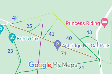
Legal History
20 Jun 1953: Aldbury 43 was recorded as a bridleway on the original definitive map and statement. DM sheet DM3-11 (SP91SE).
31 Dec 1977: Aldbury 43 was shown as a bridleway on the special review draft map and statement. DM sheets SR-52 (SP91SE).
|
|
Definitive Statement (4 Dec 2015)
Path: [Aldbury] 43. Status: Bridleway.
Definitive Map sheet: 52
Commences at junction with BR40 in N part of Aldbury Common thence NE to junction
with county road at parish boundary.
|
Maintainability
This route is maintainable at the public expense because it was a footpath or bridleway existing before 30 Apr 1959.
|
|