Legal History
20 Jun 1953: The route was recorded as CRB (Carriage Road used as a Bridleway) on the original definitive map and statement.
DM sheet DM3-11 (SP91SE).
31 Dec 1977: The route was shown as a byway open to all traffic on the special review draft map and statement.
DM sheet SR-52 (SP91SE).
19 Mar 1992: The Borough of Dacorum (Byway Open to All Traffic, Aldbury No 71) (Monument Drive) (Traffic Restricted) Order 1991 prohibits vehicles overnight between 2200 and 0700 except for access and other exemptions. Note that this prohibition includes carriages and bicycles.
2 May 2006: NERC exemption s.67(1) as route shown on DM as Byway Open to All Traffic.
7 Jun 2019: Application by landowner (National Trust) to record the width of the byway. HCC reference DAC/164.
1 Nov 2021: Application made by National Trust to the Secretary of State for a direction that Hertfordshire County Council determine the application by a set date.
2 Mar 2022: Secretary of State directed Hertfordshire County Council to determine the application by 2 May 2022. (FPS/M1900/14D/31)
4 Jul 2024: Investigation Report published by Hertfordshire County Council.
28 Nov 2024: Decision report issued by Hertfordshire County Council. An order will be made to record a variable width.
6 Feb 2025: The Hertfordshire County Council (Aldbury 71) Modification Order 2025, made 6 Feb 25 and confirmed 30 Jul 26, added a variable width to the definitive map and statement for this way.
|
| Application Process |
| Path |
Application |
Certificate |
Direction |
Inv Report |
Order |
Confirmed |
| EC1172 |
7 Jun 2019 DAC/164 |
7 Jun 2019 |
2 Mar 2022 (2 months) |
4 Jul 2024 |
6 Feb 2025 |
30 Jul 2026 |
|
Definitive Statement (26 Nov 2024)
Path: [Aldbury] 71. Status: Byway Open to All Traffic.
Definitive Map sheet: 52
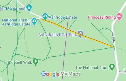
Commences at junction with county road E of Aldbury Common thence NW across
Common to Monument Clearing.
Width: Varies between 11m and 28m as shown shaded grey in the Hertfordshire County Council (Aldbury 71) Modification Order 2025.
Limitations: None
The statement ought to refer to the fact that there are junctions with other paths including Aldbury 21, 23, 25, 40, 41 and 42.
|
Maintainability
This route is maintainable at the public expense by virtue of para 7 of Sch 3 to the Countryside Act 1968. [Converted from RUPP]
|
|