Paths Greenways Bridleways Tracks
 PG: OBJECTS: PROMOTION: Batchworth 30 BW (formerly Rickmansworth 30)
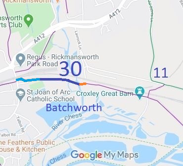
Map showing recorded Rickmansworth and Batchworth paths
Annotated map reproduced courtesy of Googlemaps.
This route starts from the High Street, Rickmansworth, as Caravan Lane (shown in light blue) then continues eastwards to a ford and footbridge at the River Chess. There is then a well-used link (shown in orange) to Lavrock Lane. It is planned to continue the route, as opportunities permit, to link with Croxley Green 11 BW.

At the time of the BHS 2022 Access Survey (6 Nov 22), there were no gates across the path but there were strategically placed bollards to prevent wide vehicles. Ridden horses would find no difficulty in passing. The only signposts seen were on the (then) footpath sections of the route and correctly indicated footpath status at the points where they had been placed. The signage was checked again on 4 Mar 24, but has not been altered to reflect the bridleway status and so is now misleading.
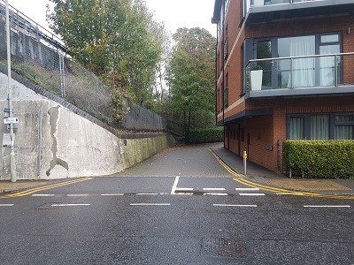
Batchworth 30 Caravan Lane (light blue section)
Photograph of Batchworth 30 Caravan Lane
View from High Street
Photo: Phil Wadey, 6 Nov 2022
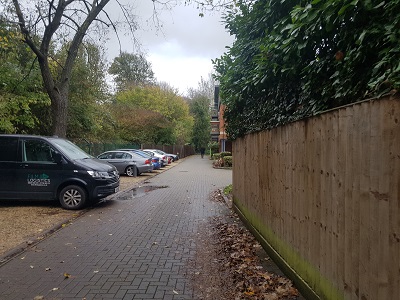
Photograph of Batchworth 30 Caravan Lane
Continuing Eastwards
Photo: Phil Wadey, 6 Nov 2022
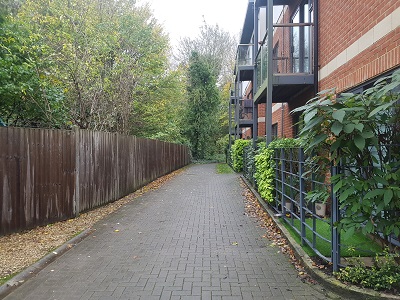
Photograph of Batchworth 30 Caravan Lane
Continuing Eastwards
Photo: Phil Wadey, 6 Nov 2022
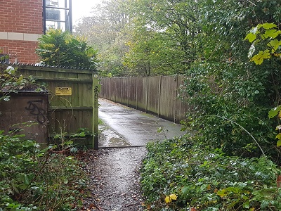
Photograph of Batchworth 30 Caravan Lane
View West from Blue path
Photo: Phil Wadey, 6 Nov 2022
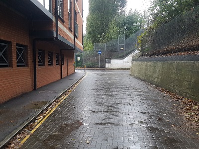
Photograph of Batchworth 30 Caravan Lane
View West to High Street
Photo: Phil Wadey, 6 Nov 2022
HCC PGBT The pale blue route is shown as part of route 57 in the emerging Three Rivers Walking and Cycling Plan (2022). As part of a longer scheduled cycling route, it provided an opportunity to record equestrian rights as part of the planned route to join Croxley Green 11 bridleway. The Three Rivers District Council made a public path creation order upgrading this section of footpath to bridleway on 19 Dec 22, and it was confirmed unopposed on 27 Jan 23. The Trust provided advice and assistance in the processing of the creation order.
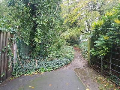
Batchworth 30 Bridleway (navy blue section)
Photograph of Batchworth 30 Bridleway
Start of dark blue route from light blue
Photo: Phil Wadey, 6 Nov 2022
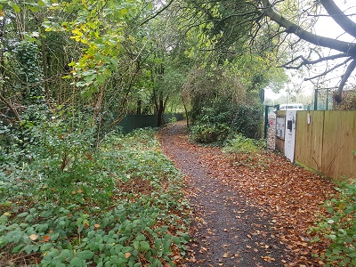
Photograph of Batchworth 30 Bridleway
Continuing Eastwards
Photo: Phil Wadey, 6 Nov 2022
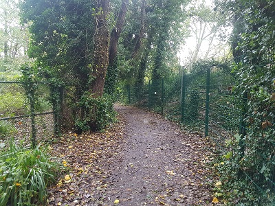
Photograph of Batchworth 30 Bridleway
Continuing Eastwards
Photo: Phil Wadey, 6 Nov 2022
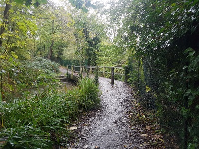
Photograph of Batchworth 30 Bridleway
Continuing Eastwards towards bridge
Photo: Phil Wadey, 6 Nov 2022
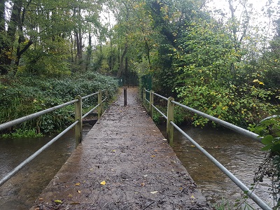
Photograph of Batchworth 30 Bridleway
Continuing Eastwards over bridge
Photo: Phil Wadey, 6 Nov 2022
HCC Open Spaces Society logo The dark blue route is shown as part of route 57 in the emerging Three Rivers Walking and Cycling Plan (2022) but had been in planning by Three Rivers District Council officers prior to publication. When the adjacent school sought to divert a footpath that went across their land, the Open Spaces Society and the Three Rivers District Council advocated the argument that 'bridleway is the best sort of new cycle track' and as a result, the Hertfordshire County Council entered into a public path creation agreement to upgrade the footpath to bridleway and to come into effect immediately it had been diverted.

Legal History
31 Dec 1977: Rickmansworth 30 was shown as a footpath on the special review draft map and statement. DM sheet SR-89 (TQ09SE).
15 Jul 2016: The Rickmansworth 30 Creation Agreement 2016
6 Sep 2016: The Hertfordshire County Council (Rickmansworth 30) Diversion Order 2016
6 Sep 2016: The Hertfordshire County Council (Rickmansworth 30) Legal Event Modification Order 2016 altered the definitive map to show the effect of the footpath diversion and the upgrade to bridleway.
1 Apr 2017: This path is now in the newly-created Batchworth parish. The path number remained the same.
15 Dec 2022: Upgrade of Batchworth 30 FP from High Street to BW 30 was approved by Three Rivers District Council Planning Committee. (Committee Report)
19 Dec 2022: The Three Rivers District Council (Batchworth 30 (part)) Creation Order 2022 was made.
23 Dec 2022: Watford Observer public notice. The close of the objection period was 23 Jan 2023.
27 Jan 2023: Creation order confirmed. Public Notice
27 May 2023: Creation order came into effect.
3 Mar 2024: Wrong status sign (FP) reported to Hertfordshire County Council, reference 401004005639.
4 Jul 2024: The Hertfordshire County Council (Batchworth 30) Legal Event Modification Order 2024 altered the definitive map to show the effect of the bridleway creation order.
Definitive Statement (4 Dec 2015)
Path: [Batchworth] 30.  Status: FP and BW.  Definitive Map sheet: 89
Commences as a footpath at junction with Station Road thence NE across FP29 and continuing along S railway fence to junction with High Street, then E from TQ 0625 9470 as bridleway (Caravan Lane) for approx. 133m to TQ 0638 9471, continues as a bridleway on S of railway fence for approx. 240m to TQ 0662 9469 to the ford and footbridge from where it continues as a footpath generally E along S of railway fence to junction with FP12 N of Croxley Hall Farm thence SE to Grand Union Canal.
Width: 4m between TQ 0625 9470 and TQ 0638 9471.
Varies between 3m and 7m between TQ 0638 9471 and TQ 0662 9469 as shown in the Rickmansworth 30 Creation Agreement 2016, and is subject to mature trees.
Limitations: Private vehicular rights exist over the length of bridleway between TQ 0625 9470 and TQ 0638 9471.
None between TQ 0638 9470 and TQ 0662 9469.
Maintenance
This route is maintainable at the public expense because it was a footpath or bridleway existing before 30 Apr 1959.
This route is maintainable at the public expense to bridleway standards on the bridleway sections by virtue of s.36(2)(d) Highways Act 1980 as it was created by a Public Path Creation Agreement and a Public Path Creation Order.
Location Information
Postcode for SATNAV for anyone inspecting path: WD3 1HQ (High Street).

© 2024 Patchetts Green Bridleways Trust. File reference: ED177.

Stats2