Patchetts Green Bridleways Trust
 PG: OBJECTS: PROMOTION: Bushey 40 and 51
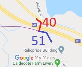
Map showing Bushey 40 and 51 bridleway
Annotated map reproduced courtesy of Googlemaps.
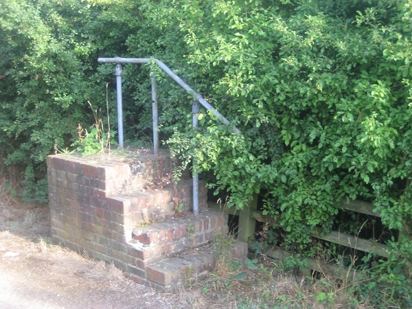
Bushey 51 mounting block
Bushey 51 Mounting Block
Photo: Phil Wadey, 8 Aug 2010
Bridleway 51 Bushey (shown in blue) used to be part of Hilfield Lane South. It was stopped up as a road, reserving bridleway rights. It connects to Bushey 40 (shown in red) which runs over a footbridge to the A41 opposite Hilfield Lane.

During the BHS Year of Access and Riding Rights of Way (ARROW) in the early 1990s, the survey of riding routes for the area by the Patchetts Green Riding Club found that this ridden bridge was only recorded as a footpath. An application was made to have it recognised as a bridleway in 1996.

The order to record the footbridge (part of Bushey 40) as a bridleway was confirmed by the County Council on 30 July 2010 and advertised on the 13 August 2010. It is necessary to lead a horse over the Bushey 40 bridge as there are height restrictions, but the former Department of Transport put mounting blocks at each end of it, so making it more convenient for equestrians. This restriction is recorded as a limitation in the order.

At the time of the BHS 2021 Access Survey (24 Sep 21), there was one open gate and the route was signposted at the northern end. Vegetation on the mounting blocks and the missing sign were reported to the county council.
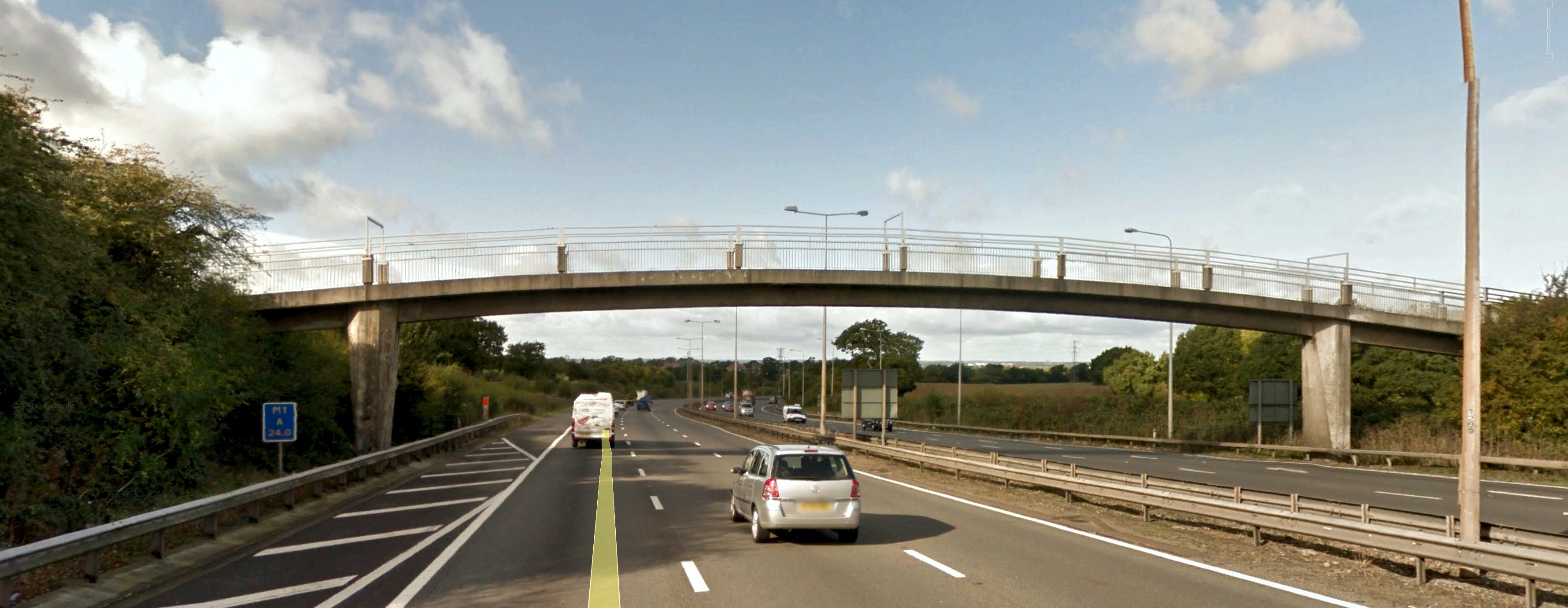
Side view of bridge carrying Bushey 40 bridleway
Photo: Chris Beney, 13 Feb 2018
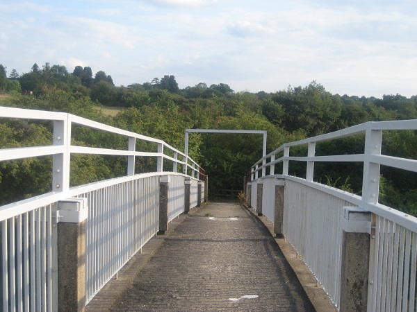
Bushey 40 goes over this bridge
Bushey 40 Bridge
Photo: Phil Wadey, 8 Aug 2010
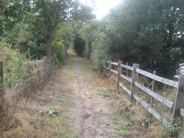
Bushey 51 bridleway
Bushey 51 Bridleway
Photo: Phil Wadey, 8 Aug 2010
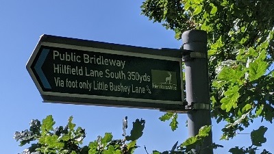
Bushey 40
1. Sign at A41 verge
Photo: Michael Rackham, 24 Sep 2021
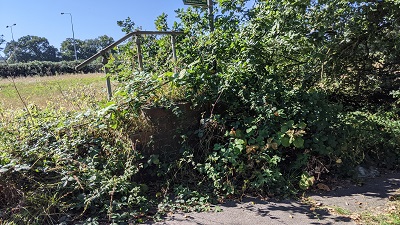
Bushey 40
2. Overgrown mounting block at A41 end
Photo: Michael Rackham, 24 Sep 2021
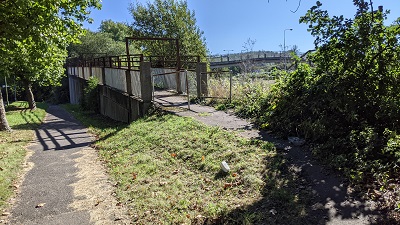
Bushey 40
3. Start of bridge at A41 end
Photo: Michael Rackham, 24 Sep 2021
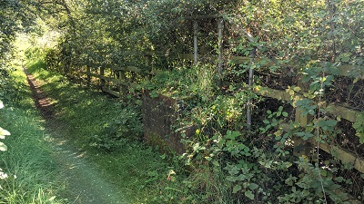
Bushey 51
4. Overgrown Bushey 51 mounting block
Photo: Michael Rackham, 24 Sep 2021
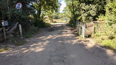
Bushey 51
5. View from Hilfield Lane South
Photo: Michael Rackham, 24 Sep 2021
BHSPGBTEvidence to demonstrate equestrian rights had been collected by the Patchetts Green Riding Club, and the application to record the route had been made by the British Horse Society's local access officer. All who used the path and completed the evidence form are thanked for playing their part in safeguarding the route for future riders.

Legal History
The Conversion of Highways into Footpaths or Bridleways (County of Hertford) (No 3) Order 1979 turned the northern part of Hilfield Lane South into Bridleway 51.
Definitive Map Modification Order application made in respect of Bushey 40, 21 Jan 1996. Turned down by Hertfordshire County Council.
15 Mar 2010: Secretary of State allowed the appeal, and directed Hertfordshire County Council to make an order recording Bushey 40 as BW.
The Hertfordshire County Council (Bushey 40) Modification Order 2010, confirmed 30 Jul 2010, recorded the bridge as a bridleway.
24 Sep 2021: Overgrowth on mounting blocks making use very difficult reported to Hertfordshire County Council. HCC references 401002259466 and 401002259499.
24 Sep 2021: Missing sign at southern end reported to Hertfordshire County Council. HCC reference 401002259734.
Definitive Statement (20 Apr 2010)
Path: [Bushey] 51.  Status: Bridleway
Commences from junction with BR40 by the bridge crossing the M1 thence in a south-easterly direction to the junction of Hilfield Lane South with the caravan park access road.
Width: Varies between 13-15 metres.

Definitive Statement (20 Apr 2010)
Path: [Bushey] 40.  Status: Footpath and Bridleway
Commences at junction with Little Bushey Lane 50 yards south of Harts Farm (same point as start of FP33) thence E across field to M1 following the boundary to join Hilfield Lane and at TQ 1539 9545 becomes BR40 and continues generally N across M1 footbridge to TQ 1541 9554 then NW to join A41 at TQ 1536 9557.
Width:
Limitations: Equestrian users must dismount and lead their horse between TQ 1539 9545 and TQ 1536 9557.
Appears on definitive map sheet: 85.

© 2021 Patchetts Green Bridleways Trust. File reference: EC141.

Stats2