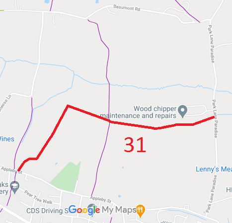
Annotated map reproduced courtesy of Googlemaps.
We need a volunteer to photograph this route for this year's Access and Riding Rights of Way Survey. It's easy - just take photographs (safely) when you use the path. Find out more!
| Paths Greenways Bridleways Tracks | ||
| PG: OBJECTS: PROMOTION: Cheshunt 31 RB Gammon's Lane | ||
Annotated map reproduced courtesy of Googlemaps. |
This route runs from Paradise Hill and heads west then turns south to Appleby Street.
We need a volunteer to photograph this route for this year's Access and Riding Rights of Way Survey. It's easy - just take photographs (safely) when you use the path. Find out more! |
| Legal History 2 Feb 1953: Recorded as CRB (Carriage Road used as a Bridleway) on the original definitive map. DM maps DM2-32 (Herts 36 SE) and DM2-37 (Herts 41 NE). 20 Aug 1969: Petty Sessional Division of Cheshunt Gammons Lane Diversion 1969. HCC reference DM2/101. 2 May 2006: Restricted Byway rights were confirmed or created on this path by virtue of ss 47 and 48 Countryside and Rights of Way Act 2000. |
Definitive Statement (4 Dec 2015)
Path: [Cheshunt] 31. Status: Restricted Byway. Definitive Map sheet: 80 Commences in Paradise Hill proceeds west then turns south to Appleby Street. |
© 2024 Patchetts Green Bridleways Trust.
