Legal History
2 Feb 1953: Cheshunt 74 was not recorded on the original definitive map and statement. DM sheet DM2-39 (Herts 41 SE).
2 Feb 1953: Cheshunt 10 was recorded as a footpath on the original definitive map and statement. DM sheet DM2-39 (Herts 41 SE). This covered part of the length of Theobalds Lane and subsequently became part of Cheshunt 75.
31 Dec 1977: Cheshunt 74 was not shown on the special review draft map and statement. DM sheets SR-80 (TL30SW) and SR-81 (TL30SE).
31 Dec 1977: Cheshunt 10 was shown as a footpath on the special review draft map and statement. DM sheet SR-81 (TL30SE). This covered part of the length of Theobalds Lane and subsequently became part of Cheshunt 75.
11 Nov 1994: BHS application made to record a bridleway along Theobalds Lane (HCC reference BRX/10)
1999: EHFS application for several routes including Theobalds Lane (HCC reference BRX/27)
22 Dec 2005: The Hertfordshire
County Council (Cheshunt 17, 70, 73, 74, 75 and Enfield 002) Modification
Order 2005 (confirmed 26 Aug 2008) added Cheshunt 74 and 75 to the definitive map and statement.
|
Definitive Statement (4 Dec 2015)
Path: [Cheshunt] 74. Status: Bridleway.
Definitive Map sheet: 80
Commences from Cheshunt 71 at TL 3438 0101 thence generally east and north east along
Theobald's Lane to join Lieutenant Ellis Way at TL 3488 0109.
Width: varying from 9 to 12 metres between TL 3438 0101 and TL 3488 0109 by
reference to the area uncoloured in the 1910 Finance Act map. Hertfordshire
County Council (Cheshunt 17, 70, 73, 74, 75 and Enfield 002) Modification
Order 2005
Limitations: None
Path: [Cheshunt] 75. Status: Bridleway.
Definitive Map sheets: 80, 81
Commences at Lieutenant Ellis Way at TL 3494 0111 thence generally north east and east
along Theobald's Lane to the A10 Great Cambridge Road, north of Rush Lodge at TL 3520 0120.
Width: varying from 7 to 13 metres between TL 3494 0111 and TL 3520 0120 by
reference to the area uncoloured on the 1910 Finance Act map. Hertfordshire
County Council (Cheshunt 17, 70, 73, 74, 75 and Enfield 002) Modification
Order 2005
Limitations: None
|

 Cheshunt 74 from E end of route
 Gate near E end of route
 Heading East along Hotel Entrance Route
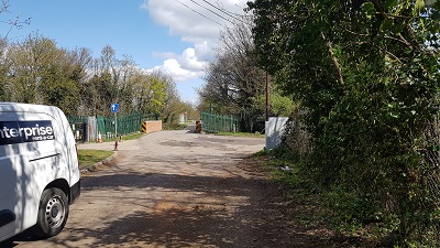 East towards New River bridge
 Cheshunt 74 looking W from A10

 This route was recorded following two applications (BHS and EHFS). The County Council's order attracted objections. The EHFS led at the inquiry and the order was confirmed, adding a whole network of paths in the vicinity.
