Paths Greenways Bridleways Tracks
 PG: OBJECTS: PROMOTION: Hatfield 41 BW
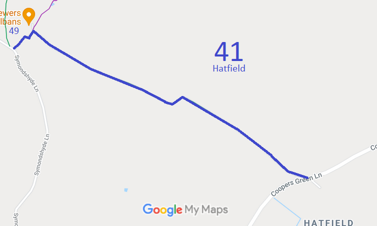
Map showing Hatfield paths
Annotated map reproduced courtesy of Googlemaps.
This route runs from Coopers Green Lane (public road), opposite Great Braitch Lane, generally northeastwards then southeast to a junction with Symondshyde Lane, close to Hatfield 49 bridleway and Hatfield 47 bridleway.

We need a volunteer to photograph this route for this year's Access and Riding Rights of Way Survey. It's easy - just take photographs (safely) when you use the path. Find out more!
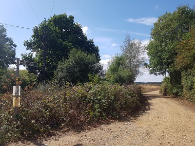
View from southern end

View from Coopers Green Lane
Photo: Phil Wadey, 21 Aug 2022
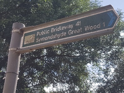
Hatfield 41 sign at southern end

Sign at start, Coopers Green Lane
Photo: Phil Wadey, 21 Aug 2022

Legal History
20 Jun 1953: Hatfield 41 was recorded as CRB (Carriage Road used as a Bridleway) on the original definitive statement, but it stopped short of Symondshyde Lane at its western end. DM sheets DM3-15 and DM3-16.
31 Dec 1977: Hatfield 41 was shown as a bridleway on the special review draft map and statement. DM sheet SR-69. There must have been an objection as the route remained a RUPP.
3 Mar 1979: Mid Herts Footpath Society applied to extend Hatfield 41 to join Symondshyde Lane.
1996: The Hertfordshire County Council (Hatfield 41 and Hatfield 50) Modification Order 1996 (confirmed 3 Jul 1998) reclassified Hatfield 41 as a bridleway and extended it the short distance to meet Symondshyde Lane.
Definitive Statement (4 Dec 2015)
Path: [Hatfield] 41.  Status: Bridleway.  Definitive Map sheets: 56 and 57
Commences at junction with Coopers Green Lane opposite Great Braitch Lane (TL 2124 1064), thence NW for a distance of approx. 700m (to TL 2065 1100), thence SW for a distance of approx. 60m (to TL 2060 1097), thence NW for a distance of approx. 750m to its junction with FP 50 (TL 1993 1130), thence generally SW around the edge of the farm for approx. 130m to its junction with the County Road Hammonds Lane, also known as Symondshyde Lane (TL 1984 1122).
Width: 3m - 7m between TL 2124 1064 and TL 1994 1130 as shown hatched on the plan forming part of the Hertfordshire County Council (Hatfield 41 and Hatfield 50) Modification Order 1996.
Minimum 4m between TL 1994 1130 and TL 1984 1122
Limitations: the right to erect a gate across the route at TL 1988 1127
the right to erect a gate across the route at TL 1999 1125
the right to erect a gate across the route at TL 2123 1064.

© 2022 Patchetts Green Bridleways Trust. File reference: EC046.

Stats2