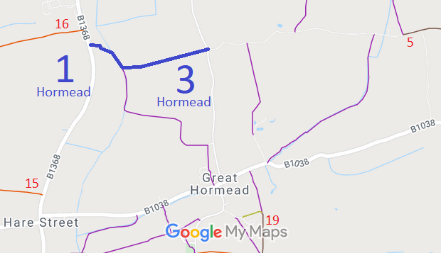
Annotated map reproduced courtesy of Googlemaps.
We need a volunteer to photograph this route for the 2022 Access and Riding Rights of Way Survey. It's easy - just take photographs (safely) when you use the path. Find out more!
| Paths Greenways Bridleways Tracks | ||
| PG: OBJECTS: PROMOTION: Hormead 1 and 3 | ||
Annotated map reproduced courtesy of Googlemaps. |
This route runs from the B1368 (not far from Anstey 16 restricted byway) to Barkway road to the junction of Flinthall Road, Andersons Lane and Brick House Lane (which leads to Hormead 5 restricted byway).
We need a volunteer to photograph this route for the 2022 Access and Riding Rights of Way Survey. It's easy - just take photographs (safely) when you use the path. Find out more! |
| Legal History 2 Feb 1953: Hormead 1 and 3 were recorded as bridleways on the original definitive map and statement. DM sheet DM1-04 (Herts 9 SW). 31 Dec 1977: Hormead 1 and 3 were shown as bridleways on the special review draft map and statement. DM sheets SR-15 (TL33SE) and SR-16 (TL43SW). 20 Sep 2015: Application to record as restricted byway. HCC reference EH/42. |
Definitive Statement (4 Dec 2015)
Path: [Hormead] 1. Status: Bridleway. Definitive Map sheet: 15 Commences at junction with Hare Street - Barkway Road N of Bradbury thence SE along N of hedge to River Quin, thence along river to bridge where it joins FP2 and BR3. Path: [Hormead] 3. Status: Bridleway.
Definitive Map sheets: 15 and 16 |
© 2022 Patchetts Green Bridleways Trust.
File reference: EC794.
