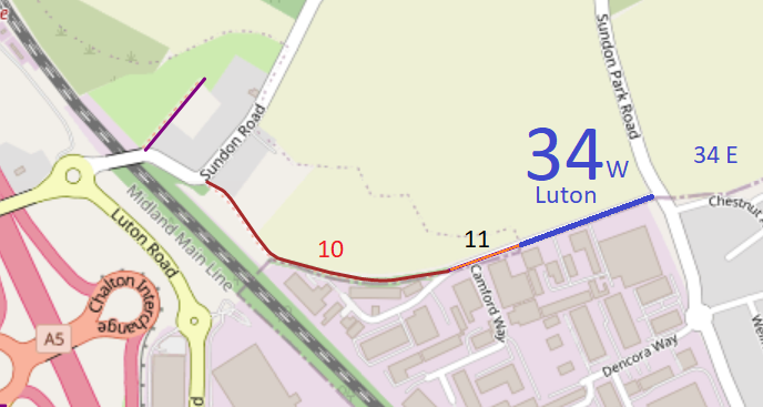
Map data from © OpenStreetMap and Central Bedfordshire Council.
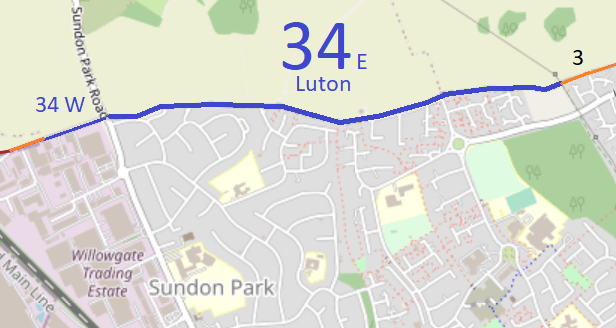
Map data from © OpenStreetMap and Central Bedfordshire Council.
| Paths Greenways Bridleways Tracks | ||
| PG: OBJECTS: PROMOTION: Luton 34 | ||
| This path number, Luton 34, has been split into two sections for this website. Select the one needed below. | |
Map data from © OpenStreetMap and Central Bedfordshire Council. |
Map data from © OpenStreetMap and Central Bedfordshire Council. |
| Legal History 19 Jan 1996: The route is shown as Luton 34 bridleway on the Definitive Map and Statement for the Former Borough of Dunstable, the Borough of Luton and the Former Leighton Buzzard and Linslade Urban and Luton Rural Districts. Map sheet 19. |
© 2023 Patchetts Green Bridleways Trust.
