Legal History
1 Nov 1953: Offley 39 was recorded as a bridleway on the original Hertfordshire definitive map and statement. DM sheet DM4-29 (Herts 11 SW), DM4-37 (Herts 19 NW) and DM4-38 (Herts 19 NE).
31 Dec 1977: The route was shown as a footpath on the Hertfordshire special review draft map and statement. DM sheet SR-27 (TL12SW).
6 Aug 1996: The owner of the land from the old road to Luton Road is Luton Borough Council, under title BD195297.
11 Feb 2019: Application to Hertfordshire County Council for restricted byway status on the Offley moiety. (Certified 20 Feb 2019.)
27 Feb 2020: Application to Luton Borough Council for restricted byway status for the Luton moiety. (Certified 28 Apr 2020.)
1 May 2021: Applied for a direction to determine.
1 Apr 2022: Secretary of State directed Luton Borough Council to determine the application by 1 Apr 2023. (FPS/B0230/14D/1)
14 Mar 2024: HCC investigation report published. Comments due by 14 Apr 24.
30 May 2024: Hertfordshire County Council reports its decision to make an order at restricted byway status, for both the Hertfordshire and Luton parts, on the historical evidence. The Luton part is with the consent of the Luton Borough Council. No order is made for the section in Luton that needs to be recorded other than through historical evidence.
2 Jan 2025: Needs resolution by the Luton Borough Council Administration and Regulation Committee to make the order (future meetings are on 13 Feb 25 and 24 Mar 25.
11 Jun 2025: Luton Borough Council’s committee approved the delegation of the order processing powers to Hertfordshire County Council in respect of this path. Video of Committee Meeting.
24 Jul 2025: The Hertfordshire County Council (Offley 39 and Luton 45) Modification Order 2025 will, if confirmed, upgrade the county-boundary footpath to restricted byway on the Hertfordshire and Luton definitive maps and statements. Objection period closed 3 Oct 2025.
10 Oct 2025: There were 11 objections, of which 7 have so far been withdrawn.
18 Dec 2025: Only one objection remains.
19 Dec 2025: Last objection withdrawn. Order is now clear for being confirmed in the New Year.
|
| Application Process |
| Path |
Application |
Certificate |
Direction |
Inv Report |
Order |
Confirmed |
| EC1040 |
11 Feb 2019 NH/313 |
20 Feb 2019 |
1 Apr 2022 (12mo) |
14 Mar 2024 |
24 Jul 2025 |
15 Jan 2026 |
| EL003 |
27 Feb 2020 |
28 Apr 2020 |
1 Apr 2022 (12mo) |
14 Mar 2024 |
24 Jul 2025 |
15 Jan 2026 |
|
|
Definitive Statement (26 Jun 2025)
Path: [Offley] 39. Recorded Status: Restricted Byway.
Definitive Map sheet: 27
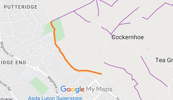
Commences from county boundary at Selsy Drive (public highway) at TL 1165 2380,
N of junction with Offley FP 8, then S and SE along county boundary for approx 990m
to junction with Luton RB 45 at TL 1215 2305.
Width: Varies between 4m and 23m as shown in the Hertfordshire County Council (Offley 39 and Luton 45)
Modification Order 2025.
Limitations: None.
Path: [Luton] 45. Recorded Status: Restricted Byway.
Definitive Map sheet: 6 and 12
Commences from county boundary at Selsy Drive (public highway) at TL 1165 2380,
N of junction with Offley FP 8 (Herts), then S and SE along county boundary for approx 990m
to junction with Luton RB 45 at TL 1215 2305 then turning sharply SW, past Slaughters Wood for approx
400m to TL 1186 2277 then S for approx 225m to meet Crawley Green Road (public
highway) at TL 1190 2255.
Width: Varies between 4m and 25m as shown in the Hertfordshire County Council (Offley 39 and Luton 45)
Modification Order 2025.
Limitations: None.
|
Maintainability
This route is maintainable at the public expense because it was a highway before 1835.
|
|
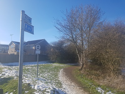 View from Luton Road northwards
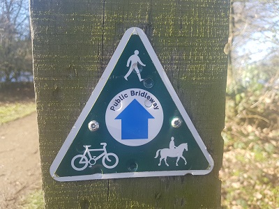 Waymark sign on path
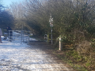 Gate and Horse Stile
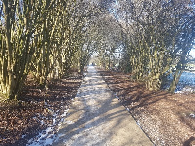 Partially surfaced route northwards
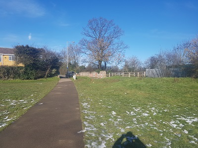 Path crosses park at northern end

 As part of the Patchetts Green Bridleways Trust's and the British Horse Society's work to record paths before
Path Extinguishment Day,
it was spotted that Offley 39 was only recorded as a footpath, yet it was ridden. It was unrecorded in Luton but was waymarked as a bridleway. The historical evidence showed a continuous route as a carriageway, so an application was made in 2019 to record the route in the two counties as a restricted byway.
The County Council (acting on behalf of itself and Luton Borough Council) agreed with the application and an order was made in 2025 and confirmed unopposed in 2026.
This is a good example of 'perfectly obvious paths' that would have been extinguished by the Countryside and Rights of Way Act 2000 had an application not been made in time.
