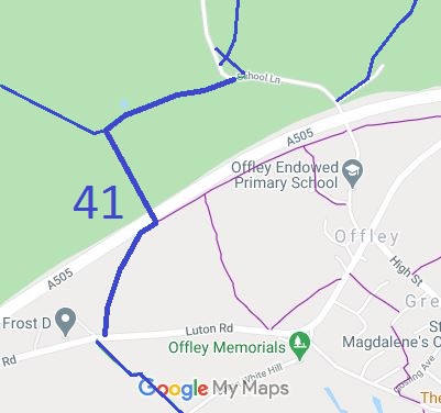
Annotated map reproduced courtesy of Googlemaps.
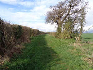
View northwards from Luton Road
Photo: Phil Wadey, 22 Mar 2017
| Paths Greenways Bridleways Tracks | ||
| PG: OBJECTS: PROMOTION: Offley 41 - Honeysuckle Lane | ||
Annotated map reproduced courtesy of Googlemaps. |
This route runs from Luton Road (near Offley 42 BW) to the A505 then generally northwards to a junction with Offley 38 BW then east to School Lane (near Offley 31 BW). Take great care at the A505 crossing. |
View northwards from Luton Road |
| Legal History 1 Nov 1953: Recorded as bridleway on the original (1953) definitive map. The Great Offley Bypass Road Scheme (Side Roads) Order 1972 diverted part of Offley 41. The newly created section was given the status of BW. 9 Nov 2017: Landowner Deposit under s.31(6) Highways Act 1980 admits as bridleway the part of Offley 41 south of the bypass road. 12 Dec 2019: The Hertfordshire County Council (Offley 41 Bridleway) Modification Order 2019 (confirmed 30 Jun 2020) recorded a width for the route and specified in the definitive statement that there were no limitations. |
Definitive Statement (28 Nov 2019)
Path: [Offley] 41. Status: BW. Definitive Map sheet: 19 Commences from Luton Road (public highway) adjacent to the Flints at TL 1348 2684 then runs generally NNE for approx 290m to Gt Offley Bypass at TL 1356 2711 following NE beside the bypass for approx 60m to TL 1361 2715 then across the bypass to TL 1360 2717 continuing generally NW for approx 260m to a junction with BR 38 at TL 1347 2739, continuing generally ENE for approx 320m to join School Lane (public highway) at Birkitt Hill at TL 1376 2751. Width: Varies between 9m and 10m between TL 1348 2684 and TL 1356 2711 and 5m and 16m between TL 1360 2717 and TL 1376 2751 as shown shaded grey on the Order Plan in the Hertfordshire County Council (Offley Bridleway 41) Modification Order 2019. Limitations: None |
© 2023 Patchetts Green Bridleways Trust. File reference: EC699.