| Paths Greenways Bridleways Tracks | ||
| PG: OBJECTS: PROMOTION: Rushden and Wallington 32 | ||
| We're collecting user evidence for the council now: Download user evidence form - Read the Instructions | ||
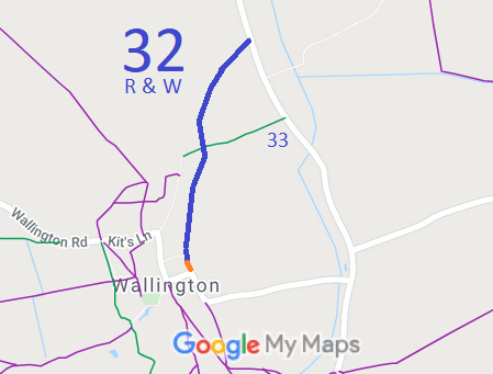
![]() Annotated map reproduced courtesy of Googlemaps. |
This route runs from Kits Lane (public road C10) generally northwards to Rushden and Wallington 33 bridleway then generally north and northeastwards to met the public road.
We have taken photos from the road, but we need a volunteer to photograph the rest of this route for this year's Access and Riding Rights of Way Survey. It's easy - just take photographs (safely) when you use the path. Find out more! |
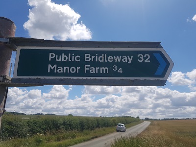
Sign at northern endPhoto: Phil Wadey, 3 Jul 2022 |
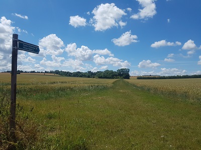
View from road at northern endPhoto: Phil Wadey, 3 Jul 2022 |
|
As part of the British Horse Society's work to record paths before
Path Extinguishment Day,
it was spotted that the recorded Rushden and Wallington 32 did not quite reach the road in Wallington, by Manor Farm. The gap is shown orange on the plan above. The historical evidence showed a continuous route, so an application was made in 2020 to record the gap. We are still collecting user statements from anyone riding this bridleway. Please fill in an evidence form and return it for when the County Council determine the application.
This is a good example of 'perfectly obvious paths' that would be extinguished by the Countryside and Rights of Way Act 2000 if an application had not been made in time.
| ||||
| Legal History 1 Nov 1953: Wallington 12 was recorded as a bridleway on the original definitive map and statement. DM sheet DM4-19. Wallington 12 became Rushden and Wallington 32 when the parishes merged. 31 Dec 1977: Rushden and Walllington 32 was shown as a bridleway on the special review draft map and statement. DM sheet SR-13. 17 Feb 2020: Application to record the gap. HCC reference NH/322. |
Definitive Statement (4 Dec 2015)
Path: [Rushden and Wallington] 32. Status: Bridleway. Definitive Map sheet: 13 Commences from end of county road E of Manor Farm thence generally N to east of village to cross BR33 thence NE to parish boundary NW of The Lodge on county road. |
© 2022 Patchetts Green Bridleways Trust. File reference: EC859. HCC reference NH/322.