Legal History
1938: The route is shown as an unclassified county road on the Hertfordshire County Council ROW survey. Map St Albans Rural 11.
20 Jun 1953: Part of the route was proposed as Sandridge 4 CRB (Carriage Road used as a Bridleway) on the original draft map and statement. The rest was not shown. DM sheets DM3-15 and DM-23.
31 Dec 1977: The route was not shown on the special review draft map and statement. DM sheets SR-56 and SR-68.
3 Apr 1998: The Hertfordshire (Jersey Lane, Sandridge) (Prohibition of Driving) Order 1997 prohibits the use of motor vehicles along this route.
2 May 2017: Application to record as a byway. HCC reference STA/159.
Mar 2020: Jersey Lane Greenspace Action Plan 2020-2030 published by HCC.
|
Definitive Map sheets: 56 and 68
|
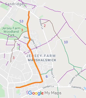
 As part of the British Horse Society's work to record paths before
Path Extinguishment Day,
it was spotted that Jersey Lane had not been recorded. The historical evidence showed a continuous route as an old road, so an application was made in 2017 to record the route.