Paths Greenways Bridleways Tracks
 PG: OBJECTS: PROMOTION: Stevenage 18, 22, 23, 105 BW and Graveley 7 and 8 BW
Stevenage Horse and Pony Route: Anti-clockwise: Verge, Pegasus Crossing and Stevenage 103. Clockwise: Turn right onto Back Lane, then Botany Bay Lane.  SHPR 
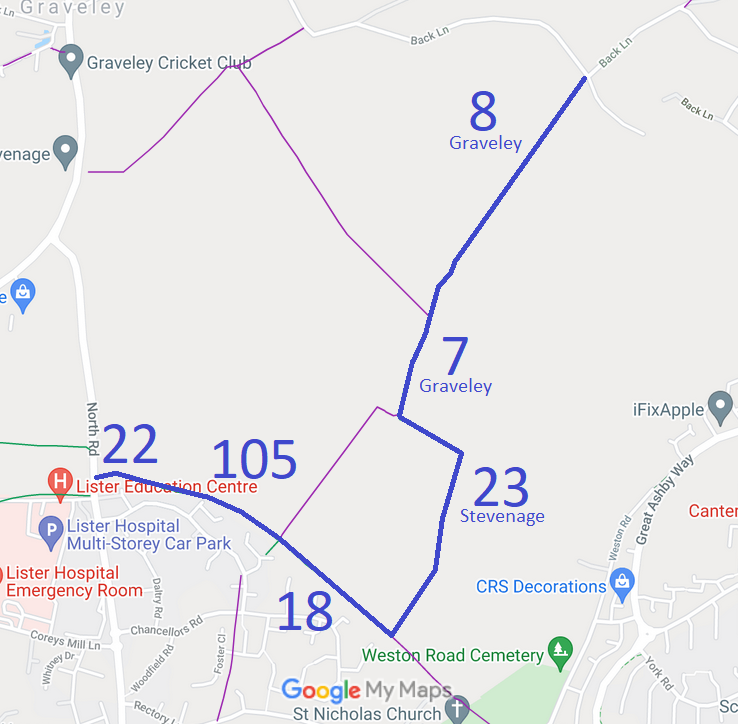
Map showing Stevenage and Graveley bridleways
Annotated map reproduced courtesy of Googlemaps.

We need a volunteer to photograph the rest of this route for this year's Access and Riding Rights of Way Survey. It's easy - just take photographs (safely) when you use the path. Find out more!

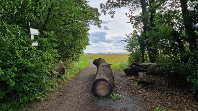
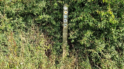
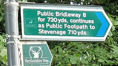
At the time of the BHS 2023 Access Survey (7 Aug 23), no gates were across Graveley 8 BW. It was signposted at the northern end, but with misleading wording as Graveley 7 has been upgraded to bridleway since the sign was put in. The waymark arrow at the southern end of Graveley 8 is the wrong (footpath) yellow colour for the continuation. Both problems were reported to Hertfordshire County Council on 8 Aug 23.

Photograph of Graveley 8 bridleway heading southwestwards Graveley 8 sign at Church Road
Photo: Linda Anderson, 7 Aug 2023
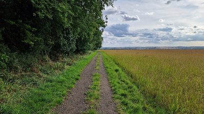
Photograph of Graveley 8 bridleway heading southwestwards Graveley 8: Heading southwest
Photo: Linda Anderson, 7 Aug 2023
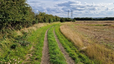
Photograph of Graveley 8 bridleway heading southwestwards Graveley 8: Continuing southwest
Photo: Linda Anderson, 7 Aug 2023
Photograph of Graveley 8 bridleway heading southwestwards Graveley 8: Continuing southwest
Photo: Linda Anderson, 7 Aug 2023
Photograph of Graveley 8 bridleway heading southwestwards Graveley 8 and 7: Waymark post
Photo: Linda Anderson, 7 Aug 2023

Legal History
1983: Stevenage 22, 105, Graveley 7 and 8 were shown in Stevenage Borough Council leaflet as part of Phase 1 SHPR which is stated as being open for use.
10 Mar 2006: Application to record Stevenage 22 FP as BW and add a BW from Stevenage 22 to Stevenage 17. HCC reference STV/22.
4 Aug 2006: The Stevenage 105 Public Path Creation Agreement 2006 came into operation, adding a bridleway between Stevenage 22 and Stevenage 17.
13 Oct 2006: The Hertfordshire County Council (Stevenage 105) Legal Event Modification Order 2006 added the English Partnerships dedicated bridleway to the definitive map and statement
The Hertfordshire County Council (Stevenage 17, 18, 22 and 23 and Graveley 7) Creation Order 2018 and the Hertfordshire County Council (Stevenage Bridleways and Stevenage 17) Extinguishment Order 2018, both confirmed 27 Jul 2018, stopped up the route that had been ridden and created a bridleway further east.
25 Jan 2019: The Hertfordshire County Council (Stevenage 17, 18, 22 and 23 and Graveley 7) Legal Event Modification Order 2019 made the changes to the definitive map and statement caused by the creation and extinguishment orders.
8 Aug 2023: Misleading footpath sign at northern end of Graveley 8 reported to HCC. Reference 401003598413.
8 Aug 2023: Misleading waymark arrow at southern end of Graveley 8 reported to HCC. Reference 401003598415.
21 Aug 2023: Hertfordshire County Council advise that a Temporary Traffic Regulation Order has been made prohibiting use for 8 weeks in a six month period while drainage works taken place.
10 Nov 2023: Spotted sign at west end of Stevenage 22 still reads 'Public Footpath' five years after the order to confirm bridleway rights exist. Reported to Hertfordshire County Council, reference 401003789846.
14 Feb 2025: Sign at west end of Stevenage 22 still reads 'Public Footpath' seven years after the order that confirmed bridleway rights exist. Reported to Hertfordshire County Council, reference 401004546082.
14 Feb 2025: Sign at west end of Stevenage 22 has moved to east side of North Lane, but the finger still reads 'Public Footpath'. This is eight years after the order that confirmed bridleway rights exist. Reported to Hertfordshire County Council, reference 102002069749.
Definitive Statement (27 Nov 2018)
Path: [Stevenage] 22.  Status: Bridleway.  Definitive Map sheet: 21
Commences from North Road (public road) at TL 2320 2679 and runs generally E for approx. 160m to join Stevenage BR 105 at TL 2336 2677.
Width: 4m
Limitations: None

Path: [Stevenage] 105.  Status: Bridleway.  Definitive Map sheet: 21
Commences at junction with Stevenage BR 22 (TL 2336 2678) then SE to junction with Stevenage BR/FP 17 and BR 18 at TL 2364 2666.
Width: 4 metres
Limitations: None

Path: [Stevenage] 18.  Status: Footpath/Bridleway.  Definitive Map sheet: 21
Commences as footpath from Weston Road (public road) to SE of St Nicholas Church and runs NW through churchyard and along field edge for approx. 400m to a junction with Stevenage BR 23 at TL 2391 2643, then continues NW as bridleway for approx. 355m to a junction with Stevenage BR/FP 17 and Stevenage BR 105 at TL 2364 2666.
Width: 4m between TL 2406 2629 and TL 2364 2666.
Limitations: None between TL 2406 2629 and TL 2364 2666.

Path: [Stevenage] 23.  Status: Bridleway.  Definitive Map sheet: 21
Commences froma junction with Stevenage FP/BR 18 at TL 2391 2643 and runs generally NNE for approx. 470m to TL 2407 2667 where it turns to run generally NW for approx. 175m and N for approx. 10m to a junction with Stevenage FP 17 at TL 2302 2696, then continues NNE for aprox 170m to the parish boundary at TL 2396 2712 and the junction with Graveley 7.
Width: 4m
Limitations: None

Path: [Graveley] 7.  Status: Footpath/Bridleway.  Definitive Map sheet: 21
Commences from FP6 SW of Rectory thence SE to a junction with Graveley BR 8 at TL 2399 2719 and then runs as a bridleway SSW fr approx. 75m to the parish boundary at TL 2396 2712.
Width: 4m between TL 2399 2719 and TL 2396 2712.
Limitations: None between TL 2399 2719 and TL 2396 2712.

Path: [Graveley] 8.  Status: Bridleway.  Definitive Map sheet: 21
Commences from county road immediately W of Chesfield Park Lodge thence SW along W edge of Ten Acre Plantation to a junction with BR 7 at TL 2399 2719.
© 2023 Patchetts Green Bridleways Trust. File reference: EC384 (Stevenage 22 and 105), EC475 (creation and extinguishments)

Stats2