Patchetts Green Bridleways Trust
 PG: OBJECTS: PROMOTION: St Stephen Millhouse Lane
We're collecting user evidence for the council now: Download user evidence form - Read the Instructions
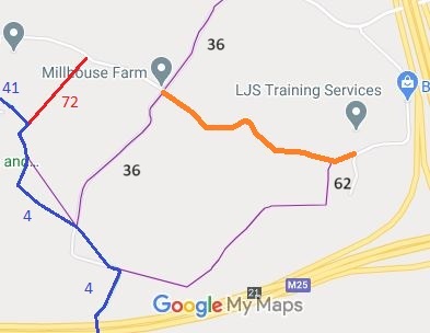
Map showing the Millhouse Lane track
Annotated map reproduced courtesy of Googlemaps.
This route (shown in orange) runs from Millhouse Lane (public road), near Millhouse Farm, generally southeastwards or eastwards to Searches Lane (public road). Within living memory it was in use properly as a road, but it fell into disuse by motor vehicles.

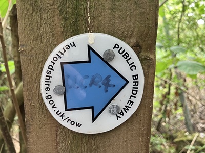
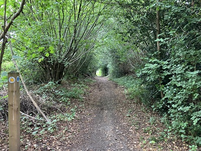
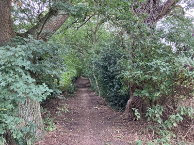
At the time of the 2025 Access Survey (3 Aug 25), the path was unobstructed. A blue County Council waymark arrow had been used at one end.
Photograph of Milhouse Lane, Bedmond
Waymark near Searches Lane end
Photo: Helen Taylor, 3 Aug 2025
Photograph of Milhouse Lane, Bedmond
Continuing westwards
Photo: Helen Taylor, 3 Aug 2025
Photograph of Milhouse Lane, Bedmond
Continuing westwards
Photo: Helen Taylor, 3 Aug 2025
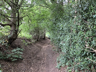
Photograph of Milhouse Lane, Bedmond
Continuing westwards
Photo: Helen Taylor, 3 Aug 2025
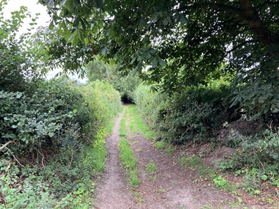
Photograph of Milhouse Lane, Bedmond
Continuing westwards
Photo: Helen Taylor, 3 Aug 2025
BHS PGBTAs part of the Patchetts Green Bridleways Trust's and the British Horse Society's work to record paths before Path Extinguishment Day, it was spotted that this section of Millhouse Lane did not look like a road on the ground and hence needed to be recorded before it was forgotten. The historical evidence showed a continuous route, so an application was made in 2003 to record the gap.

If you have ridden the route, please download a user evidence form and then follow the instructions and return the form to us. It only takes a few minutes to fill in (the whole form fits on one side of a piece of A4 paper). If you have any other questions, please email us.

This is a good example of 'perfectly obvious paths' that would become unrecordable by the Countryside and Rights of Way Act 2000 if an application had not been made in time.

Legal History
1938: The route is shown as an unclassified road (brown line) on the Hertfordshire County Council ROW survey. Map St Albans Rural 15.
20 Jun 1953: The route was not recorded on the original definitive map and statement.
31 Dec 1977: The route was not shown on the special review draft map and statement.
28 Jul 2003: Application made to record byway status. HCC reference STA/93.
2 May 2006: NERC exemption s.67(2)(b) as route not on DM but was on LOS.
28 Jun 2018: Application made to the Secretary of State to direct Hertfordshire County Council to determine the application. (FPS/M1900/14D/14) Direction granted.
17 Mar 2020: Hertfordshire County Council advise that they have started to investigate this application.
14 Jul 2023: Hertfordshire County Council publish their investigation report. Comments are due back by 11 Aug 23.
26 Sep 2023: Hertfordshire County Council decided to make an order, according to FOI request in Jan 2024.
Application Process
Path Application Certificate Direction Inv Report Order Confirmed
EC200 28 Jul 2003 STA/93 4 May 2010 10 Oct 2018 (12mo) 14 Jul 2023 Awaited  
Maintainability
This route is maintainable at the public expense because it was a highway before 1835.

© 2025 Patchetts Green Bridleways Trust. File reference: EC200. HCC reference STA/93.

Stats2