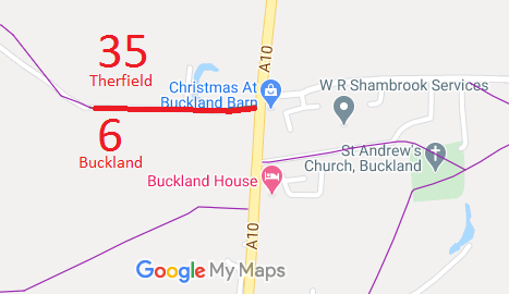
Annotated map reproduced courtesy of Googlemaps.
We need a volunteer to photograph this route for this year's Access and Riding Rights of Way Survey. It's easy - just take photographs (safely) when you use the path. Find out more!
| Paths Greenways Bridleways Tracks | ||
| PG: OBJECTS: PROMOTION: Therfield 35 BOAT | ||
Annotated map reproduced courtesy of Googlemaps. |
We need a volunteer to photograph this route for this year's Access and Riding Rights of Way Survey. It's easy - just take photographs (safely) when you use the path. Find out more! |
| Legal History |
Definitive Statement (4 Dec 2015)
Path: [Therfield] 35. Status: Bridleway. Definitive Map sheets: 7, 14 and 15 Commences from county road at NE corner of Chapel Green thence generally SE along western side of Brandish Wood thence along east side of Field Barn to join parish boundary at Bull Lane thence E along same to join A10 opposite Barkway Road. |
© 2022 Patchetts Green Bridleways Trust.