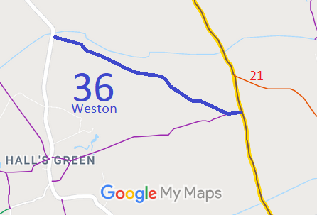
Annotated map reproduced courtesy of Googlemaps.
We need a volunteer to photograph this route for this year's Access and Riding Rights of Way Survey. It's easy - just take photographs (safely) when you use the path. Find out more!
| Paths Greenways Bridleways Tracks | ||
| PG: OBJECTS: PROMOTION: Weston 36 | ||
Annotated map reproduced courtesy of Googlemaps. |
This page is still being prepared.
We need a volunteer to photograph this route for this year's Access and Riding Rights of Way Survey. It's easy - just take photographs (safely) when you use the path. Find out more! |
| Legal History |
Definitive Statement (4 Dec 2015)
Path: [Weston] 36. Status: Bridleway. Definitive Map sheet: 22 Commences from Church End - Halls Green Road thence SE along Lolleywood Lane to join BOAT 12 (Clothall) at parish boundary on W side of Luffenhall Common. |
© 2021 Patchetts Green Bridleways Trust.
