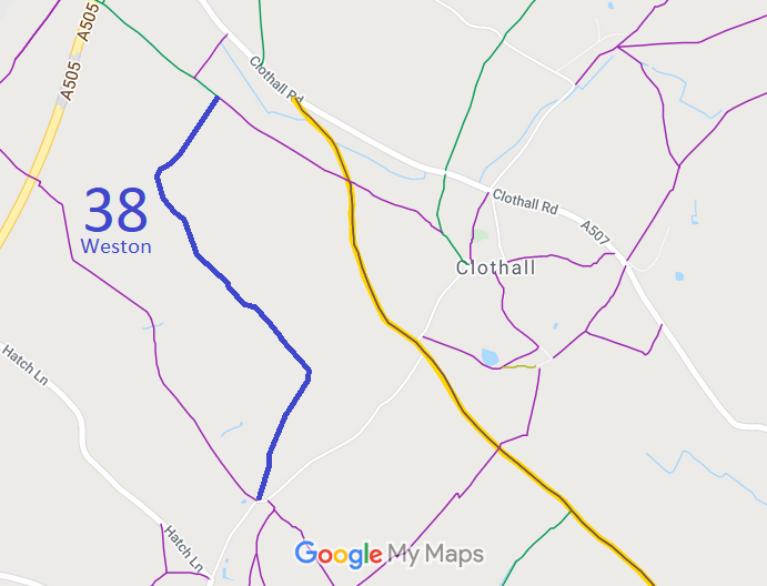
Annotated map reproduced courtesy of Googlemaps.
We need a volunteer to photograph this route for this year's Access and Riding Rights of Way Survey. It's easy - just take photographs (safely) when you use the path. Find out more!
| Paths Greenways Bridleways Tracks | ||
| PG: OBJECTS: PROMOTION: Weston 38 | ||
Annotated map reproduced courtesy of Googlemaps. |
This page is still being prepared.
We need a volunteer to photograph this route for this year's Access and Riding Rights of Way Survey. It's easy - just take photographs (safely) when you use the path. Find out more! |
| Legal History 1 Nov 1953: This route was recorded as a bridleway on the original definitive map and statement. DM sheet DM4-18 (Herts 7 SE). 31 Dec 1977: This route was shown as a bridleway on the special review draft map and statement. DM sheet SR-13 (TL23SE). |
Definitive Statement (4 Dec 2015)
Path: [Weston] 38. Status: Bridleway. Definitive Map sheets: 13 Commences from county road at Green End thence NE and NW along NE side of Green Grove thence to point NE of Newfield Hill thence NE to join BR1, SW of Windmill Hill. |
© 2023 Patchetts Green Bridleways Trust.
