Legal History
1938: The route is just outside the survey area on the Hertfordshire County Council ROW survey.
Map St Albans Rural 15.
20 Jun 1953: The route was not recorded on the original definitive map and statement.
DM sheet DM3-29.
31 Dec 1977: The route was not shown on the special review draft map and statement.
DM sheet SR-75.
19 Jan 1990: The Three Rivers (Serge Hill Lane Abbots Langley) Footpath Modification Order 1990 added this route to the definitive map and statement as a footpath.
3 Jan 2017: Application to record as restricted byway. HCC reference 3R/97.
|
| Application Process |
| Path |
Application |
Certificate |
Direction |
Inv Report |
Order |
Confirmed |
| EC974 |
3 Jan 2017 3R/97 |
11 Apr 2017 |
|
|
|
|
|
Definitive Statement (4 Dec 2015)
Path: [Abbots Langley] 77. Recorded Status: Footpath.
Definitive Map sheet: 75
Commences from Serge Hill Lane, Abbots Langley, adjacent to the White Hart Public House, Grid Ref: TL0992 0392 thence in a southerly direction to its junction with Millhouse Lane, Abbots Langley, Grid Ref: TL0992 0379.
Width: unspecified
|
Maintainability
This route is maintainable at the public expense because it was a footpath or bridleway existing before 30 Apr 1959.
|
|
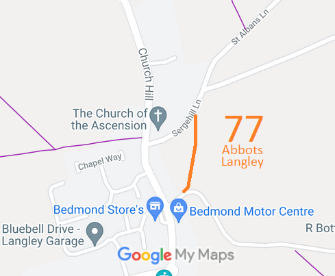

 As part of the British Horse Society's work to record paths before
Path Extinguishment Day,
it was spotted that this 'footpath' appeared to be an old road, so an application was made in 2017 to record it as a restricted byway.
