Legal History
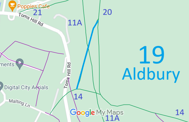
The draft map showed this route as a bridleway. It was downgraded to footpath as a result of Objection 59m.
20 Jun 1953: Aldbury 19 was recorded as a footpath on the original definitive map and statement.
DM sheet DM3-11 (SP91SE).
31 Dec 1977: Aldbury 19 was shown as a footpath on the special review draft map and statement.
DM sheet SR-52 (SP91SE).
30 Nov 2024: Aldbury 19 is shown as a bridleway on Hertfordshire County Council's online rights of way map.
|
|
Definitive Statement (4 Dec 2015)
Path: [Aldbury] 19. Recorded Status: Footpath.
Definitive Map sheet: 52
Commences at junction with BR14 W of Lodge to Old Copse thence NE across BR11A to
junction with BR20 opposite Old Copse.
|
Maintainability
This route is maintainable at the public expense because it was a footpath or bridleway existing before 30 Apr 1959.
|
|