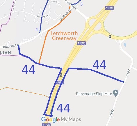
Annotated map reproduced courtesy of Googlemaps.
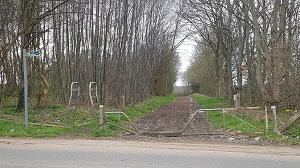
View from Eastern end of path
Photo: 28 Mar 2021
| Paths Greenways Bridleways Tracks | ||
| PG: OBJECTS: PROMOTION: Letchworth 44 BW - Old Willian Lane | ||
| Letchworth Garden City Greenway: Clockwise: Greenway route 3 (shown as thin line). Anti-clockwise: Greenway route 4 (shown in orange). | LGW | |
Annotated map reproduced courtesy of Googlemaps. |
Letchworth 44 BW starts on Baldock Lane (public road) near Letchworth 4 BW and heads generally eastwards to the side of the A1(M) motorway. It turns southwards to an underpass then returns northwards to pick up its original line and reach Jacks Hill (B197 public road). |
View from Eastern end of path |
| Legal History 1838: The very western end of Letchworth Garden City 44 is shown on the Graveley tithe map as unnumbered, not subject to an apportionment, and is labelled 'from Hitchin'. 1839: Letchworth Garden City 44 (apart from section diverted for A1(M) purposes) was shown on Willian tithe map as not subject to an apportionment. 1 Nov 1953: This path number was not used on the original definitive map and statement. DM sheet: DM4-18 (Herts 7 SE) Part has been diverted to use an underpass as a result of the A1(M) construction. 24 Jan 2000: The Hertfordshire County Council (Old Willian Lane) Public Path Creation Agreement 2000 formally allowed this route to be recorded as a bridleway. |
Definitive Statement (4 Dec 2015)
Path: [Letchworth Garden City] 44. Recorded Status: Bridleway. Definitive Map sheet: 12 Commences from a junction with Baldock Lane at TL 2276 3076 and continues generally SE for approx 170m along Old Willian Lane to a junction with Letchworth FP3 at TL 2285 3064 and continues generally E for approx 390m to TL 2321 3054 and then continues generally S along the western side of the A1(M) for approximately 520m to TL 2305 3005 and continues generally E through an underpass for approx 70m to TL 2312 3005 and continues generally N along the eastern side of the A1(M) for approx 520m to TL 2328 3054 and continues generally E for approx 580m along Old Willian Lane to a junction with Jacks Hill (B197) at TL 2384 3041. Width: Varying between 5m and 18m as shown hatched on the plan to the Hertfordshire County Council (Old Willian Lane) Public Path Creation Agreement dated 24/01/2000. Limitations: Gates or barriers with a gap of at least 1.5m at TL 2278 3066 and TL 2383 3041. |
© 2024 Patchetts Green Bridleways Trust.