Definitive Statement (5 May 15)
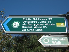
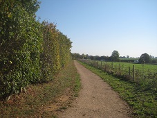
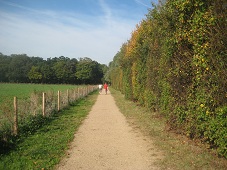
Path: [Aldenham] 92. Status: Bridleway
Commences from the junction with Bushey BR 56 at TQ 1388 9794 (parish boundary) and
continuing N for approx. 370m to join Aldenham FP & BR 15 at TQ 1344 9829.
Width: 7 metres
Limitations: None
Appears on definitive map sheet: 84.
Path: [Bushey] 70. Status: Bridleway
A BR commencing at Bushey BR 54 at TQ 1336 9791 and continuing N along the field for approx. 30m to join Aldenham BR 92 at parish boundary at TQ 1337 9794.
Width: 7m.
Limitations: None.
Appears on definitive map sheet: 84.
Path: [Aldenham] 15. Status: Footpath/Bridleway
Commences as BR from Church Lane (public road) at TQ 1382 9824 thence west along
northern boundary of Berrygrove to junction with Aldenham BR 92 at TQ 1344 9829.
Continues as FP SW through Berrygrove to junction with Aldenham BR 76 at TQ 1312 9822. Then continues as BR generally NW (past Aldenham FP 91 (Wendy Way)) at TQ 1284 9850 along the woodland track for approx. 670m to join Aldenham BR 22 at TQ 1266 9868.
Width: 7m between TQ 1382 9824 and TQ 1344 9829.
Varying between 9.2m and 10.4m from TQ 1266 9868 and TQ 1312 9822.
Limitations: Subject to the right of the owner or occupier for teh time being of teh land traversed by the BR to stack timber thereon but not so as to totally or unreasonably prevent passage from grid reference TQ 1312 9822 to Bridleway 22 Aldenham.
Appears on definitive map sheet: 84.