
Annotated map reproduced courtesy of Googlemaps.

 Bridleway Aldenham 93 is also known as 'The Crescent'. It runs from Church Lane (public road) to Aldenham 77 bridleway.
At the time of the BHS 2021 Access Survey (13 Dec 21), no gates were across the path and it was signposted at each end.
 Sign at junction with Church Lane
Photo: Phil Wadey, 1 Oct 2011
 View from Church Lane
Photo: Michael Rackham, 13 Dec 2021

Path starts as metalled route
Photo: Michael Rackham, 13 Dec 2021

Take the left-hand fork
Photo: Michael Rackham, 13 Dec 2021

Pass to the right of the house
Photo: Michael Rackham, 13 Dec 2021

Track parallel to Aldenham 77
Photo: Michael Rackham, 13 Dec 2021
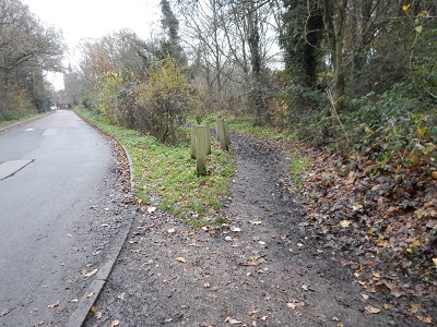
View of path from Aldenham 77
Photo: Michael Rackham, 13 Dec 2021
 An application for The Crescent to be recorded was made in 1994 following the PGRC-executed British Horse Society
ARROW survey of ridden routes, where it was found that the route was being used as a bridleway but was not on the definitive map.
The route was dedicated (for the avoidance of doubt) by the Hertfordshire County Council as part of the Wall Hall major project. This process removed the need for the modification order process to be followed.
We are grateful to the Hertfordshire County Council Rural Estates department for agreeing to (re-)dedicate this route. Part of it was walked following the official opening of the routes by the Chairman of the County Council and publication of a leaflet on 13 Dec 13.
