Paths Greenways Bridleways Tracks
 PG: OBJECTS: PROMOTION: Brickendon Liberty 24 RB
London Orbital Bridleroute: Anti-clockwise: Cock Lane to Brickendon Liberty 28. Clockwise: Hertford Heath 8.  H25 
We need a volunteer to photograph this route for this year's Access and Riding Rights of Way Survey. It's easy - just take photographs (safely) when you use the path. Find out more!
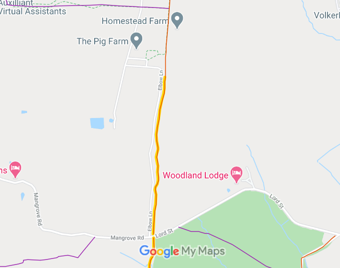
Map showing Brickendon Liberty 24 restricted byway (northern section)
Annotated map reproduced courtesy of Googlemaps.
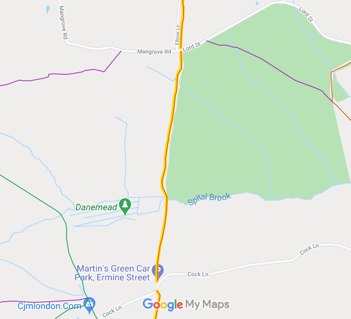
Brickendon Liberty 24 restricted byway (RB) starts from Hertford Heath 8 RB and runs generally southwards to close to the junction of Mangrove Road and Lord Street (both public roads). It crosses the road, and continues southwards to Cock Lane. Map showing Brickendon Liberty 24 restricted byway (middle section)
Annotated map reproduced courtesy of Googlemaps.
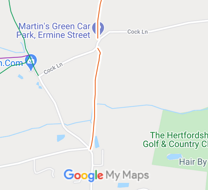
The southernmost section of Brickendon Liberty 24 restricted byway (RB) crosses Cock Lane and runs generally southwards to the public road. Map showing Brickendon Liberty 24 restricted byway (southern section)
Annotated map reproduced courtesy of Googlemaps.

Legal History
4 Jul 1890: The Broxbourne and Hoddesdon Open Spaces and Recreation Grounds Act 1890 declared and defined part of this route to be public carriageway. (Carriageway 18.)
2 May 2006: Restricted Byway rights were confirmed or created on this path by virtue of ss 47 and 48 Countryside and Rights of Way Act 2000.
18 Sep 2017: The Ermine Street (Great Grove) Management Company Ltd applied to delete the southern section of RB 24 from the definitive map. HCC reference EH/460.
20 Jul 2022: Hertfordshire County Council were directed by the Secretary of State to determine the application by 20 Oct 22. (FPS/M1900/14D/30)
23 Jul 2024: Hertfordshire County Council Investigation report issued.
27 Mar 2025: Hertfordshire County Council turned down the downgrading attempt. The route remains a restricted byway.
14 Aug 2025: Applicant appealed against the refusal of the County Council to delete the path from the definitive map. PINS reference ROW/3363792. The appeal was dismissed by an Inspector acting on behalf of the Secretary of State on 3 Mar 2026.
Definitive Statement (4 Dec 2015)
Path: [Brickendon Liberty] 24.  Status: Restricted Byway.  Definitive Map sheet: 71
Commences at parish boundary S of Elbow Lane Farm S past Box Wood and Dalmonds Wood thence S through Highfield and Hoddesdon Park Wood to junction with county road at Martins Green thence S through Nursery Grove to Little Grove junction with county Road at Little Grove.
Maintainability
This route is maintainable at the public expense by virtue of s.49(1) Countryside and Rights of Way Act 2000. [RB converted from RUPP]

© 2025 Patchetts Green Bridleways Trust. File reference: EC1010. HCC reference: EH/460.

Stats2