| Patchetts Green Bridleways Trust | ||
| PG: OBJECTS: PROMOTION: Bushey 72 Nightingale Lane | ||
![]() Annotated map reproduced courtesy of Googlemaps. |
Nightingale Lane, recorded as bridleway Bushey 72 in 2016, runs from Bournehall Lane to Bournehall Avenue, close to the Moatfield.
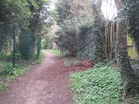
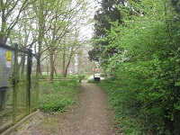
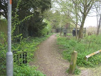
It is a natural continuation route for riders using bridleway Bushey 55. At the time of the BHS 2021 Access Survey (13 Sep 21), the route was correctly signposted at each end. There was one locked gate (photograph 2) with inadequate space to its side for horses. However, as shown in photograph 3, it is possible to swap to a path on the north side, which then links to Bournehall Lane without a gate. |
![]() 1. Sign at Bournhall Lane Photo: Michael Rackham, 13 Sep 2021 |
![]() 2. Junction with Bournehall Lane Photo: Michael Rackham, 13 Sep 2021 |
|
![]() 3. Looking southeast to gateway Photo: Michael Rackham, 16 Sep 2021 |
![]() 4. Heading northeastwards Photo: Michael Rackham, 13 Sep 2021 |
![]() 5. Heading northeastwards Photo: Michael Rackham, 13 Sep 2021 |
![]() 6. Heading northeastwards Photo: Michael Rackham, 13 Sep 2021 |
![]() 7. Looking SE from Bournehall Avenue Photo: Michael Rackham, 13 Sep 2021 |
The application to record the route had been made by the Bushey and District Footpaths Association.
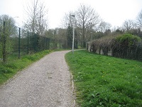
The Trust collected evidence of use of the path on horse and by bicycle, to add to the walker evidence previously submitted by the Bushey and District Footpaths Association. This led to an order being made to record the route as a bridleway, which was then confirmed. The time from application to confirmed order was 20 years and 22 days.
|
| Legal History 1840: Nightingale Lane was shown on the Bushey tithe map as not subject to an apportionment. 21 Jan 1996: Application made by Bushey and District Footpaths Association to record Nightingale Lane. 18 Dec 2015: The Hertfordshire County Council (Bushey 72) Modification Order 2015 was made to record this route as a bridleway. 4 Mar 2016: Order confirmed by Hertfordshire County Council as an unopposed order.
|
Definitive Statement (2 Nov 2015)
Path: [Bushey] 72. Status: Bridleway Commences from Bournehall Lane (public highway) at TL 1355 9562 running generally NW along the Moat Field pavillion access track for approx. 75m to a point where it diverges from the access track at TL 1350 9568. Continuing generally NW for approx. 85m then generally N for approx. 75m to join Bournehall Avenue (public highway) at TL 1345 9582. Width: Varies between 3.15m and 12.5m as shown shaded grey in the Hertfordshire County Council (Bushey 72) Modification Order 2015. Limitations: None | |||||||||||||||||||||
© 2024 Patchetts Green Bridleways Trust. File reference: EC139
![]() Photo: Phil Wadey, 2 Apr 2014 |