Paths Greenways Bridleways Tracks
 PG: OBJECTS: PROMOTION: Graveley 15 RB and Wymondley 24 RB - Turf Lane
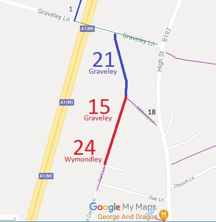
Map showing Graveley 21 bridleway
Annotated map reproduced courtesy of Googlemaps.
Graveley 15 is a restricted byway running from Green Lane (Graveley 21 bridleway) generally south-southeastwards to a junction with to a junction with the adopted part of Turf Lane (public road). Graveley 15 runs along the parish boundary, and the width of the restricted byway that falls into Wymondley parish is known as Wymondley 24.


15 Jul 21: The old footpath signs are still at the southern end of the route, three and a half years after the route was confirmed as a restricted byway. The Hertfordshire County Council were notified of this on 15 Jul 21 so that riders are not misled by the signage on site.
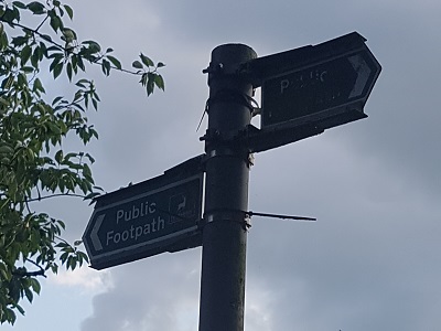
Misleading sign at Junction with Turf Lane

Sign at junction with (metalled) Turf Lane
Photo: Phil Wadey, 14 Jul 2021
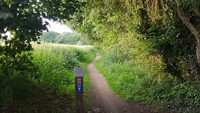
View northwards from the metalled part of  Turf Lane

View northwards from metalled part of Turf Lane
Photo: Phil Wadey, 14 Jul 2021

BHSIn 2013, the local Ramblers representative applied to add a footpath between the then recorded footpaths Graveley 15 and 18 and the metalled road to the north. As part of the BHS checks whenever an application is made to modify the definitive map, the BHS access officers spotted that this was a ridden route and consequently collected evidence that the route had been used with horses. However, an examination of the histric evidence revealled Graveley 15 to be an old road, and so it was an order was made to record it as a restricted byway. This was contained in an order making other changes, one of which was objected to, so the county council severed the order (a legal process) and added this restricted byway to the definitive map unopposed.

This is a good example of the need for riders and cyclists to check orders and applications even when they appear to be for footpaths, lest a path be incorrectly recorded at too low a status.

Legal History
1838: Wymondley 24 is shown on the Graveley tithe map as unnumbered and not subject to an apportionment.
The South of Graveley - North of Radwell (Baldock By-Pass) Special Roads (Improvements) Order 1963 stopped up all highway rights over Green Lane.
4 Apr 2013: Ramblers application for footpath based on user evidence.
2 Jul 2014: BHS application for bridleway based on user evidence.
The Hertfordshire County Council (Graveley 15, 18 and 21 and Wymondley 24) Modification Order 2016 (confirmed in respect of this path on 16 Nov 2017) added this route to the definitive map and statement as a bridleway.
Definitive Statement (6 Dec 2015)
Path: [Graveley] 15.  Status: Restricted Byway.  Definitive Map sheet: 21
Turf Lane. Runs along the parish boundary between Graveley and Wymondley. Commences at the junction of Milksey Lane/Graveley FP 18 and Green Lane/Graveley BR 21 at TL 2299 2816 thence SSW along the track for approx 210m to the junction with Turf Lane (public road) at TL 2292 2796.
Width: Between 5.5m and 12m as shown in the Hertfordshire County Council (Graveley 15, 18 and 21 and Wymondley 24) Modification Order 2016.
Limitations: None.

Path: [Wymondley] 24.  Status: Restricted Byway.  Definitive Map sheet: 21
Turf Lane. Runs along the parish boundary between Graveley and Wymondley. Commences at the junction of Milksey Lane/Graveley FP 18 and Green Lane/Graveley BR 21 at TL 2299 2816 thence SSW along the track for approx 210m to the junction with Turf Lane (public road) at TL 2292 2796.
Width: Between 5.5m and 12m as shown in the Hertfordshire County Council (Graveley 15, 18 and 21 and Wymondley 24) Modification Order 2016.
Limitations: None.

© 2022 Patchetts Green Bridleways Trust. File reference: EC705.

Stats2