
- Wymondley 1 and Letchworth 1 BW, from Graveley Lane to Roxley Road
- Wymondley 6 and Ippollitts 27 BW
- Wymondley 22 and Ippollitts 24 BW

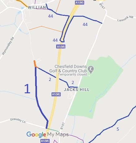
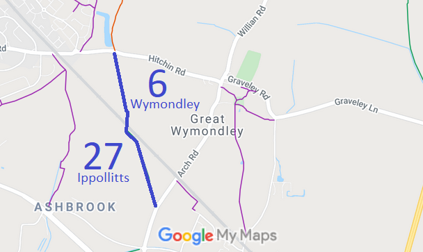
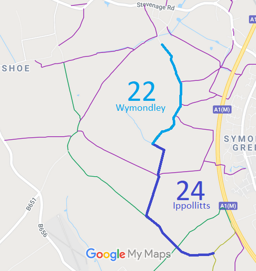
Annotated maps reproduced courtesy of Googlemaps.


 Local Government: Formerly within Hitchin Rural District. From 1974, part of North Hertfordshire District.
Inclosure (Great and Little Wymondley) (1811).
 The Wymondley Parish Council has adopted a Neighbourhood Development Plan (2019), which counts as part of the Local Development Plan when planning applications are considered.
