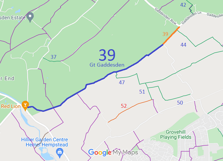
Annotated map reproduced courtesy of Googlemaps.
We need a volunteer to photograph this route for this year's Access and Riding Rights of Way Survey. It's easy - just take photographs (safely) when you use the path. Find out more!
| Paths Greenways Bridleways Tracks | ||
| PG: OBJECTS: PROMOTION: Great Gaddesden 39 | ||
Annotated map reproduced courtesy of Googlemaps. |
This route starts from Red Lion Lane (public road) and continues generally north eastwards to the junction of Gaddesden Row (public road) and Gaddesden Lane (public road). Part of the route is concurrent with part of Cupid Green Lane.
We need a volunteer to photograph this route for this year's Access and Riding Rights of Way Survey. It's easy - just take photographs (safely) when you use the path. Find out more! |
|||
|
| |||||||||
© 2025 Patchetts Green Bridleways Trust.
