Paths Greenways Bridleways Tracks
 PG: OBJECTS: PROMOTION: Great Gaddesden 44
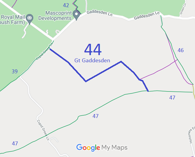
Map showing recorded Great Gaddesden paths
Annotated map reproduced courtesy of Googlemaps.
This path starts from Cupid Green Lane (both public road and recorded bridleway) and continues southeastwards, northeastwards and southeastwards to end on Great Gaddesden 47 bridleway

We need a volunteer to photograph this route for this year's Access and Riding Rights of Way Survey. It's easy - just take photographs (safely) when you use the path. Find out more!

Legal History
20 Jun 1953: Great Gaddesden 44 was shown as part CRF (Carriage Road used as a Footpath) and part bridleway on the original definitive map and statement. DM sheet DM3-13.
31 Dec 1977: Great Gaddesden 44 was shown as a bridleway on the special review draft map and statement. DM sheet SR-54.
10 Nov 1982: The Dacorum District Council (RUPP 44 - Great Gaddesden) Public Path Diversion Order 1982, if confirmed, diverted the RUPP.
16 Nov 1982: London Gazette announcement of making the order.
Definitive Statement (4 Dec 2015)
Path: [Great Gaddesden] 44.  Status: Bridleway.  Definitive Map sheet: 54
Commences at junction with county road SW of Corner Farm thence SE, NE and SE skirting SW boundary of Hay Wood to junction with BR47 S of Hay Wood.
Maintainability
The 1953 bridleway part of the route is maintainable at the public expense because it was a footpath or bridleway existing before 30 Apr 1959.
The rest of the route is maintainable at the public expense by virtue of para 7 of Sch 3 to the Countryside Act 1968. [Converted from RUPP]

© 2025 Patchetts Green Bridleways Trust.

Stats2