Paths Greenways Bridleways Tracks
 PG: OBJECTS: PROMOTION: Great Munden 65
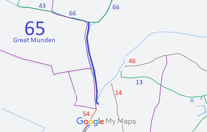
Map showing recorded Great Munden paths
Annotated map reproduced courtesy of Googlemaps.
This route runs from Great Munden 66 BW generally southwards to Haultwick Lane (public road).

We need a volunteer to photograph this route for this year's Access and Riding Rights of Way Survey. It's easy - just take photographs (safely) when you use the path. Find out more!

HCC The East Herts Footpaths Society applied in 2003 for this route to be recorded as part of a netowrk of related paths. The county council made an order recording the route as a restricted byway, but despite strong arguments for that status, the inspector decided that only bridleway rights were proven.

Legal History
1839: The northern end of Great Munden 65 was shown on the Ardeley tithe map as not subject to an apportionment.
30 Jul 2003: Application made by EHFS to record as a byway. HCC reference EH/284.
20 Jan 2012: The Hertfordshire County Council (Ardeley 3, 52 and 53, Great Munden 65, 66 and 67 and Walkern 43) Modification Order 2012 (confirmed 21 February 2017) added this route to the definitive map and statement as a bridleway. Planning Inspectorate reference FPS/M1900/7/81.
Definitive Statement (3 Jan 2012)
Path: [Great Munden] 65.  Status: Bridleway.  Definitive Map sheet: 31
Commences at junction with Great Munden BW 66 at TL 3326 2463, and continues along the Old Bourne parallel to Great Munden FP 20 and Great Munden FP 18 for approx 600m to the junction with the Hautwick Road (public road) at TL 3331 2406.
Width: Varies between 8m and 65m as shown shaded grey on Part 3 of the Order Plan attached to the Hertfordshire County Council (Ardeley 3, 52 and 53, Great Munden 65, 66 and 67 and Walkern 43) Modification Order 2012.
Limitations: None.

© 2024 Patchetts Green Bridleways Trust. File reference: EC389. HCC reference: EH/284. PINS reference: FPS/M1900/7/81.

Stats2