Paths Greenways Bridleways Tracks
 PG: OBJECTS: PROMOTION: Harpenden Common
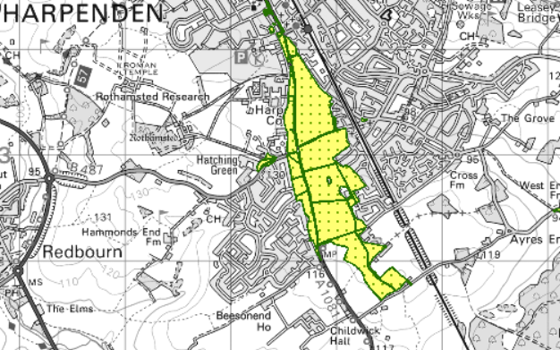
Map showing recorded Hertfordshire paths
Annotated map reproduced courtesy of MAGIC.
This is a common which was in an Urban District prior to 1974. As such it has rights of access on horseback, unless these have otherwise been restricted. The 2010 byelaws provide that no person shall ride a horse except on a designated route for riding or in exercise of a lawful right or privilege, and that where riding is permitted, no person shall ride in such a manner as to cause danger to any other person.

The Harpenden Common Management Plan refers to a horse ride round the edge of the common, and the Harpenden Town Council has been proactive in keeping this usable all year round by appropriate surfacing works.

We need a volunteer to photograph routes on the common for this year's Access and Riding Rights of Way Survey. It's easy - just take photographs (safely) when you use the paths. Find out more!

Commons Information

Common Land Number: CL16
Area: 113,669 sq m
Equestrian Rights: s.193 LPA 1925 Former Urban District

Legal History
This land is subject to byelaws made under section 15 of the Open Spaces Act 1906 by the Harpenden Town Council with respect to Harpenden Common in 2010.
Harpenden Common Management Plan.
13 Jan 2022: Surfacing of various sections of horse ride permitted by the Secretary of State. PINS reference COM/3283887.
17 May 2024: Surfacing of various sections of horse ride permitted by the Secretary of State. PINS reference COM/3326946.

© 2024 Patchetts Green Bridleways Trust.

Stats2