Legal History
2 Feb 1953: Hertford Heath 5 was recorded as Little Amwell 5 bridleway and Great Amwell 29 bridleway on the original definitive map and statement. DM sheets DM2-23 (Herts 29 SE) and DM2-30 (Herts 36 NE).
31 Dec 1977: Hertford Heath 5 was shown as Little Amwell 5 bridleway and Great Amwell 29 bridleway on the special review draft map and statement. DM sheet SR-60 (TL31SE).
1 Apr 1990: The parish of Hertford Heath was created out of Little Amwell and parts of neighbouring parishes, resulting in some path number changes.
|
Definitive Statement (4 Dec 2015)
Path: [Hertford Heath] 5. Status: Bridleway.
Definitive Map sheet: 60
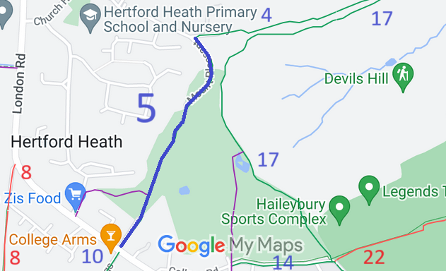
Commences at junction with county road at New Zealand Cottages, Little Amwell, thence E
to Priors Wood, thence SW meeting FP23 at TL 3526 1105, and joining the Hertford -
Hoddesdon Road opposite Old East India College Arms P.H. (Former Little Amwell BR5
and Great Amwell BR29).
|