Legal History
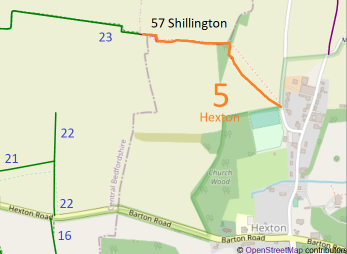
1837: Hexton 5 was shown on the Hexton tithe map labelled 'footway'.
1938: The route is shown as a footpath (unnumbered) (red dots) on the Hertfordshire County Council ROW survey.
Map Hitchin Rural West 3 (Herts 6 SW).
1 Nov 1953: Hexton 5 was recorded as a footpath on the original definitive map and statement.
DM sheet DM4-13 (Herts 6 SW).
31 Dec 1977: Hexton 5 was shown as a footpath on the special review draft map and statement.
DM sheet SR-10 (TL13SW).
1 Apr 1984: The parish of Higham Gobion was abolished and incorporated into Shillington.
It looks like Higham Gobion 5 has become Shillington 57.
Central Bedfordshire Definitive Statement
Path: [Shillington] 57. Recorded Status: Footpath.
From: Henton in Hertfordshire it runs for some 400 yards inside Bedfordshire Boundary.
To: Barton in the Clay
The path is a footpath.
It starts from footbridge on Bedfordshire-Hertfordshire boundary and heads due west for some 400 yards. It is not paved.
District: Ampthill Urban and Rural Districts
Could usefully cite junctions with Hexton 5 and Barton-le-Clay 23.