| Paths Greenways Bridleways Tracks | ||
| PG: OBJECTS: PROMOTION: Hoddesdon 74 - Ratty's Lane | ||
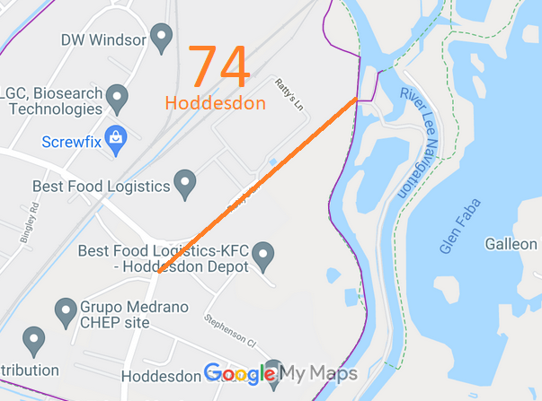
![]() Annotated map reproduced courtesy of Googlemaps. |
This route starts on Essex Road (public road) and continues northeastwards to end at the watercourse.
We need a volunteer to photograph this route for this year's Access and Riding Rights of Way Survey. It's easy - just take photographs (safely) when you use the path. Find out more! |
|||
As part of the British Horse Society's work to scrutinise orders affecting equestrian paths that are made by local autorities, the British Horse Society objected to the order that would record Ratty's Lane as a footpath. The BHS believes that there is evidence that means the route should be recorded as a restrcited byway.

| ||||
This route is shown in the Hertfordshire Rights of Way Improvement Plan 2017/18-2027/28 as route 1/87.
| ||||
| Legal History The Hertfordshire County Council (Hoddesdon 74) Modification Order 2019 will, if confirmed, add this route to the definitive map and statement as a footpath. |
DRAFT Definitive Statement (2021)
Path: [Hoddesdon] 74. Draft Status: Footpath. Definitive Map sheet: 72 Ratty's Lane. Commences at a jct with Essex Rd (public highway) at TL 3849 0865 running NE across Stephenson Close SE of the roundabout then along Ratty's Lane for approx 685m to a jct with FP 59 and FP 63 adjacent to Fieldes Weir Lock at TL 3900 0911. Width: 18 ft Limitations: None |
© 2023 Patchetts Green Bridleways Trust. File reference: EC1009.