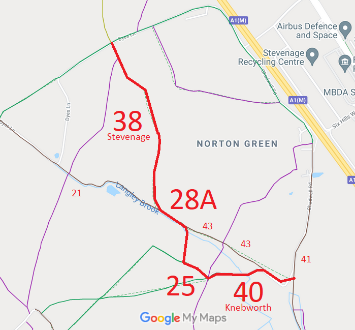
Annotated map reproduced courtesy of Googlemaps.
We need a volunteer to photograph this route for this year's Access and Riding Rights of Way Survey. It's easy - just take photographs (safely) when you use the path. Find out more!
| Paths Greenways Bridleways Tracks | ||
| PG: OBJECTS: PROMOTION: Knebworth 28A, 25 and 40 BOAT and Stevenage 38 BOAT | SHPR | |
Annotated map reproduced courtesy of Googlemaps. |
We need a volunteer to photograph this route for this year's Access and Riding Rights of Way Survey. It's easy - just take photographs (safely) when you use the path. Find out more! |
| Legal History 1995: The Hertfordshire County Council (Stevenage 38, Knebworth 28a, Knebworth 25 (part) and Knebworth 40) Modification Order 1995 (confirmed 4 Jan 1997) added this route to the definitive map and statement. PINS reference FPS/M1900/7/5. |
Definitive Statement (4 Dec 2015)
Path: [Stevenage] 38. Status: Byway Open to All Traffic. Definitive Map sheet: 29 Commences at TL 2200 2381 at junction with BR37 and BR98 Stevenage (Dyes Lane) thence generally S along Kitching Lane for approx 70m to a junction with FP11 Langley at TL 2204 2374 continuing generally S along NE boundary of Upper Kitching Spring and parish boundary for approx 680m to enter Knebworth at TL 2221 2312 N of Oak Grove and join BOAT28a Knebworth. Width: 4.5m to 22m Path: [Knebworth] 28A. Status: Byway Open to All Traffic.
Definitive Map sheet: 29 Path: [Knebworth] 25. Status: Byway Open to All Traffic/Footpath.
Definitive Map sheet: 29 Path: [Knebworth] 40. Status: Byway Open to All Traffic.
Definitive Map sheet: 29 |
© 2021 Patchetts Green Bridleways Trust. File reference: EC043.