Paths Greenways Bridleways Tracks
 PG: OBJECTS: PROMOTION: Lilley 27 Lilleyhoo Lane
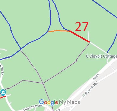
Map showing Lilley 27 restricted byway
Annotated map reproduced courtesy of Googlemaps.
This route starts at the junction of Lilley 9 and Lilley 12 and runs along the historic route of Lilleyhoo Lane to join the metalled section of Lilleyhoo Lane.

We need a volunteer to photograph this route for this year's Access and Riding Rights of Way Survey. It's easy - just take photographs (safely) when you use the path. Find out more!
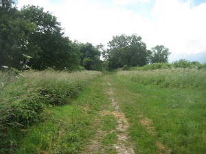
Lilley 27 photograph

View northwards from Luton Road
Photo credit: Phil Wadey, 10 Jul 2016

Legal History
1 Nov 1953: Not recorded on the original (1953) definitive map.
25 Apr 2016: Application for Restricted Byway.
4 Nov 2016: Hertfordshire County Council (Lilley 27) Order 2016 (confirmed 13 Jan 2017) recorded a restricted byway with 60ft width.
Definitive Statement (27 Oct 2016)
Path: [Lilley] 27.  Status: RB.  Definitive Map sheet: 19
Lilleyhoo Lane commences from junction with BR 9 at FP 12 at TL 1253 2694 then runs SE along Lilleyhoo Lane for approx. 201m to join the public road at TL 1271 2684.
Width: Varies between 20m and 21m between TL 1253 2694 and TL 1271 2684 as shown shaded grey on the Order Plan in the Hertfordshire County Council (Lilley 27) Modification Order 2016.
Limitations: None

© 2022 Patchetts Green Bridleways Trust. File reference: EC915.