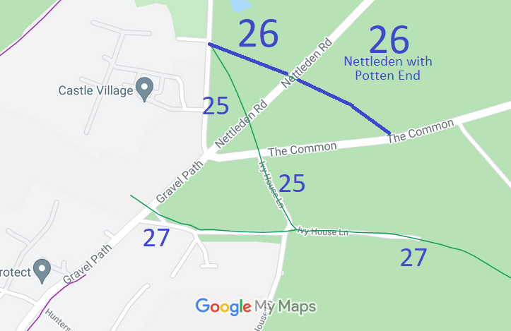
Annotated map reproduced courtesy of Googlemaps.
A volunteer has photographed this route for this year's Access and Riding Rights of Way Survey, and the page will be updated shortly. Find out more!
| Paths Greenways Bridleways Tracks | ||
| PG: OBJECTS: PROMOTION: Nettleden with Potten End 26 | ||
Annotated map reproduced courtesy of Googlemaps. |
This route starts on the public road by the golf club house, and runs generally southeastwards to Nettleden Road (public road). It continues on the west side of the road, generally northwestwards to a junction with
Nettleden with Potten End 25 bridleway and the public road.
A volunteer has photographed this route for this year's Access and Riding Rights of Way Survey, and the page will be updated shortly. Find out more! |
|
| |||||||||
© 2024 Patchetts Green Bridleways Trust.
