
Patchetts Green Bridleways Trust
Ridge 32
| PG: OBJECTS: PROMOTION: Ridge 2 and 32 BW |
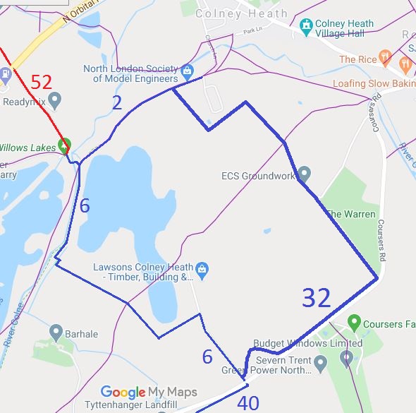 Annotated map reproduced courtesy of Googlemaps. |
Bridleway 32 runs from Ridge 6 off Coursers Lane opposite Ridge 40, then deviates round a pond before following just 'behind the hedge' from Coursers Lane to the parish boundary. It then turns north westwards and approximately follows the parish boundary before heading south west then north west round a water treatment works to join Ridge 2 BW. Ridge 2 leads west to Ridge 6 or east to Colney Heath village.
We need a volunteer to photograph this route for this year's Access and Riding Rights of Way Survey. It's easy - just take photographs (safely) when you use the path. Find out more! |
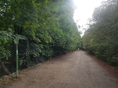 Ridge 2 from Eastern End Photo: Phil Wadey, 23 Aug 2022 |
||


 This route was achieved in three pieces of work. The first, from outside the former entrance to Coursers Farm, on Coursers Lane, to the boundary of Colney Heath common had been identified as one used but not recorded in the survey
of bridleroutes performed by the Patchetts Green Riding Club as part of
the British Horse Society's ARROW project in 1991. An application
was then made to record the route, but it was found that the path
crossed land held by the transport section of the County Council
in case of future road widening. The Council were pleased to (re-)dedicate
the route as bridleway to enable the path to be recorded by the short method.
Our thanks go to the Trustees of the Tyttenhanger Estate, Willow Farm, the St Albans Footpath Society and the British Horse Society for their respective pieces of work to achieve this useful network of paths. |
||||
| Legal History 25 Aug 1994: Part 1: Deed of Dedication by the landowners, the Hertfordshire County Council. 5 Dec 1996: The Hertfordshire County Council (Ridge 32) Legal Event Modification Order 1996 added this bridleway to the definitive map. Details for Parts 2 and 3 are yet to be added.
23 Sep 2023: Box obstruction reported to Hertfordshire County Council, reference 401003699671. |
Definitive Statement (4 Dec 2015)
Path: [Ridge] 32. Status: BW. Definitive Map sheet: 78 Commences from the County Road (Coursers Road) opposite FP8 Ridge at TL 2035 0479 thence generally north-eastwards on the north-western side of a hedge which runs parallel and adjacent to Coursers Road, between the hedge and a post and rail fence to the parish boundary with Colney Heath Parish and the Common at TL 2055 0496. Width: Varying between 10 and 13 feet. |
© 2023 Patchetts Green Bridleways Trust.
File reference: EC088.

 The link westwards from the first part to Ridge 6 was created as part of a rationalisation scheme for the Tyttenhanger Estate. However, the order inadvertently put the route through a pond, so it had to be diverted out to its current line. This diversion was achieved at the same time as the creation of the link northwards to Ridge 2. That path was created during a further rationalisation scheme on the Estate in which the St Albans Footpath Society played a leading role.