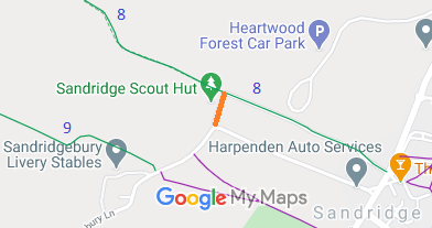
Annotated map reproduced courtesy of Googlemaps.
We need a volunteer to photograph this route for this year's Access and Riding Rights of Way Survey. It's easy - just take photographs (safely) when you use the path. Find out more!

 As part of the Patchetts Green Bridleways Trust’s and British Horse Society’s work to record paths before
Path Extinguishment Day,
it was spotted that this route was in use by walkers, riders and cyclists but was not on the definitive map of rights of way.
If you have ridden the route, please download a user evidence form and then follow the instructions and return the form to us. It only takes a few minutes to fill in (the whole form fits on one side of a piece of A4 paper). If you have any other questions, please email us.
 This route is shown in the Hertfordshire Rights of Way Improvement Plan 2017/18-2027/28 as route 7/94.
