
Patchetts Green Bridleways Trust
South Mimms 76
| PG: OBJECTS: PROMOTION: South Mimms 76 (previously Potters Bar 76) |
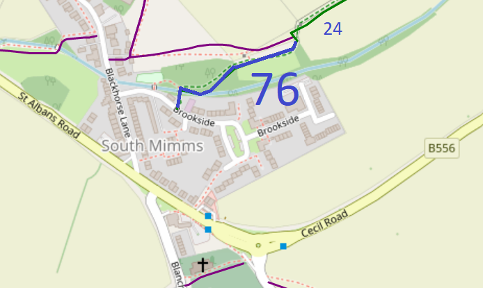 Map data © OpenStreetMap and Hertfordshire County Council. |
This route runs from Brookside (public road) to South Mimms 24 bridleway. It includes a wide bridge over the brook.
At the time of the BHS 2023 Access Survey (6 Jan 23), there were no gates or other obstructions across the path. It was properly signposted at the junction with the road and the bridge over the brook was good for equestrian use. |
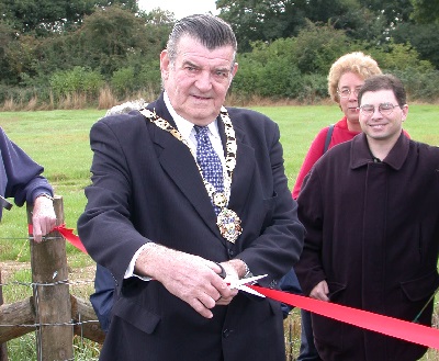 Mayor of Hertsmere opens Path |
||
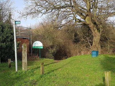 Path starts from Brookside Photo: Phil Wadey, 6 Jan 2023 |
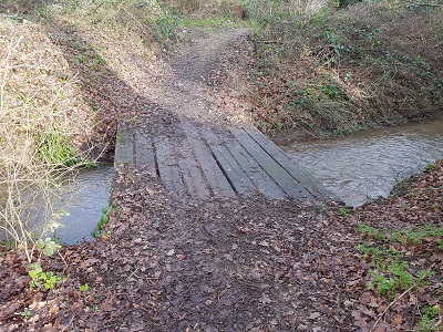 Bridge over the Brook Photo: Phil Wadey, 6 Jan 2023 |
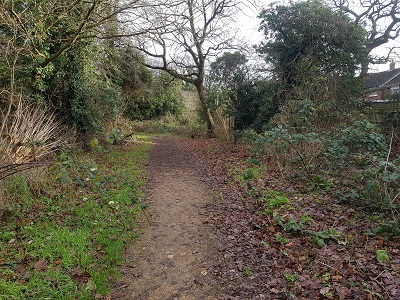 Rising from Brook Photo: Phil Wadey, 6 Jan 2023 |
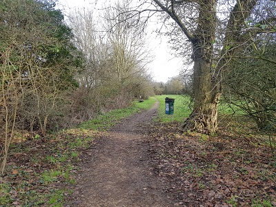 Heading generally eastwards Photo: Phil Wadey, 6 Jan 2023 |
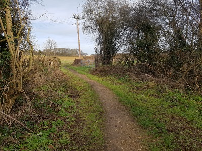 Junction with Bridleway 24 Photo: Phil Wadey, 6 Jan 2023 |


 At the time of the Patchetts Green Riding Club's 1991 ARROW survey for the
British Horse Society, Potters Bar 24 BW was a cul-de-sac on the definitive map. Evidence suggested that it should have continued to meet Blackhorse Lane in South Mimms village, but a definitive map modification order application
would taken many years to be processed. An approach was made to the Hertsmere Borough Council, who owned the adjacent land. They agreed to dedicate a bridleway on their land, and this was completed in 1996. They also agreed to make two orders: a creation order to establish rights from the bridleway they had created on their own land to Potters Bar 24, and a second order to move Potters Bar 24 to be a field edge path instead of being an unhelpful distance away from the field edge. The land agent for the owners agreed not to contest the creation order provided the diversion was achieved. After the orders had been made, but before they were confirmed, the land agent changed. The new agent objected to both orders. The Council sat tight. It sent the creation order to the Secretary of State for confirmation. However, before it was considered by an Inspector, the land agent changed again, and the new one withdrew the objections. The Secretary of State then confirmed the creation order, and Hertsmere confirmed the diversion order. The result is that there is now a through route from Swanland Road, under the A1(M), to South Mimms village. |
||||
| Legal History 18 Jan 1996: Deed of Dedication executed by the Hertsmere Borough Council. File reference EC149. 30 Jul 1999: The Hertfordshire County Council (Potters Bar 76) Legal Event Modification Order 1999 added this path to the definitive map. Remainder created by The Hertsmere Borough Council (Bridleway 24 Potters Bar) Public Path Creation Order 1995 (confirmed 5 Feb 2001) The Hertfordshire County Council (Potters Bar 76) Legal Event Modification Order 2001 added this path to the definitive map. |
Definitive Statement (5 May 15)
Path: [South Mimms] 76. Status: Bridleway Definitive Map sheet: 78 Commences from TL 2235 0152, at junction with BR24 & FP30, thence generally S to TL 2235 0151 thence generally WSW to TL 2226 0148, thence generally SW to TL 2222 0144 thence generally S, fording Catherine Bourne, to county road at Brookside at TL 2219 0142. Width: 4 metres Limitations: A gate not less than 5 feet (1.53m) wide at TL 2219 0142 close to junction with Brookside. |
© 2023 Patchetts Green Bridleways Trust. File reference: EC149 (dedication), EP002/ED067 (creation and diversion).