Patchetts Green Bridleways Trust
 PG: OBJECTS: PROMOTION: Standon 41
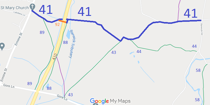
Map showing Standon 41 bridleway
Annotated map reproduced courtesy of Googlemaps.
When the current A10 was constructed bridleway Standon 41 was cut in half. An underpass was put in (see Standon 92) and this has been used by walkers cyclists and some riders. Other riders have used bridleways 89 and 88 to use an alternative underpass to the south, which has more headroom, but is shared with motor vehicles.

Standon 41 bridleway starts on Ermine Street (the old A10) by St Mary's Church, and runs generally southeastwards to a junction with Standon 88 bridleway then north east to the underpass. There is a short piece of Standon 88 bridleway to ride to return to Standon 41, which then continues generally east and southeast to a junction with bridleway Standon 43, and then further eastwards to end on Barwick Road.
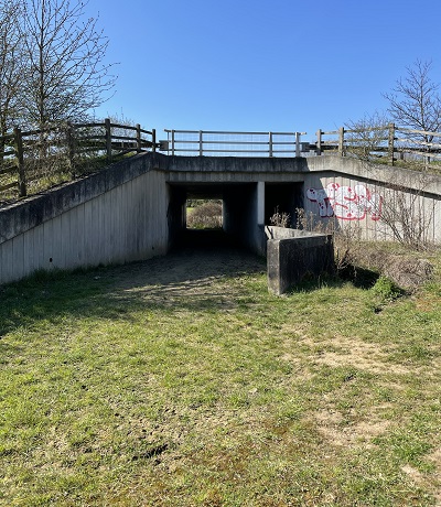
A10 underpass

A10 underpass
Photo credit: Sarah Le Quang Sang, 29 Mar 2021

Legal History
31 Dec 1977: Standon 41 was shown as a bridleway on the special review draft map and statement. DM sheet SR-32 (TL32SE).
Hertfordshire County Council (Standon 41, 42, 88 and 89) Legal Event Modification Order 2009
Definitive Statement (4 Dec 2015)
Path: [Standon] 41.  Status: Bridleway.  Definitive Map sheet: 32
Commences from county road N of Hanging Wood Farm thence W between Plashes Wood and Hanging Wood Plantation thence SW to Plashes Farm, thence NW and W through Plashes Wood to the eastern boundary of the A10 and junction with Standon BR 88 at TL 3743 2048. Recommencing at the western boundary of the A10 at TL 3738 2048 continuing generally west to N of St Mary's Church.

© 2024 Patchetts Green Bridleways Trust.