Paths Greenways Bridleways Tracks
 PG: OBJECTS: PROMOTION: Stevenage 57 RB - Fishersgreen Lane
Stevenage Horse and Pony Route: Anti-clockwise: Medway then Kitchin Lane. Clockwise: Sainsbury's Link and A602 underpass.  SHPR 
Map showing Stevenage 57 restricted byway
Annotated map reproduced courtesy of Googlemaps.
This route starts on Hitchin Road (public road) and heads generally southwestwards, crossing an estate road and a wide railway bridge to end on Fishers Green Road (public road).

At the time of the BHS 2022 Access Survey (16 Jan 22), no gates were across the path and it was signposted at each end.
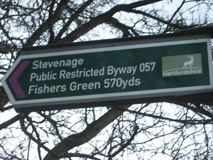
Stevenage 57 sign, Hitchin Road

Sign at junction with Hitchin Road
Photo: Phil Wadey, 24 Dec 2015
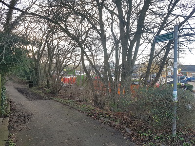
Photograph of Stevenage 57 Junction with Hitchin Road
Photo: Phil Wadey, 16 Jan 2022
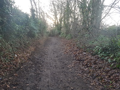
Photograph of Stevenage 57 Heading Southwest
Photo: Phil Wadey, 16 Jan 2022
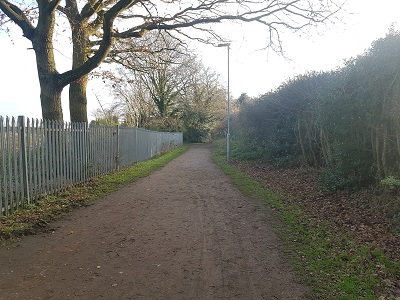
Photograph of Stevenage 57 South of Railway Bridge
Photo: Phil Wadey, 16 Jan 2022
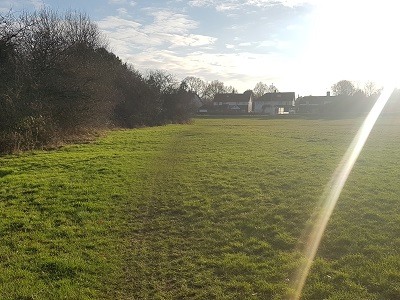
Photograph of Stevenage 57 Side of Fishers Green
Photo: Phil Wadey, 16 Jan 2022
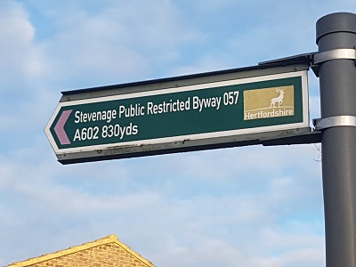
Photograph of Stevenage 57 Sign at Fishers Green Road
Photo: Phil Wadey, 16 Jan 2022
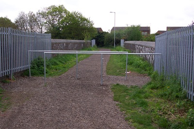
Railway bridge Obstruction

Obstruction on railway bridge (now removed)
Photo: Phil Wadey, 7 May 2006

BHS Following complaints from riders that an obstruction (pictured) was blocking the path, one of the British Horse Society's access officers researched the historical evidence and found that the route could be shown to have been a public road. An application to record it as a byway was made. The County Council agreed with the application and an order was made in 2008 to record the route as a restricted byway. It was subsequently confirmed unopposed and the obstruction was removed.

This is a good example of 'perfectly obvious paths' that would be extinguished by the Countryside and Rights of Way Act 2000 if an application had not been made in time.

Legal History
1983: The route is shown in Stevenage Borough Council leaflet as part of Phase 1 SHPR which is stated as being open for use.
8 Dec 2004: This route is described as part of the existing Stevenage Horse and Pony Route on the Stevenage Local Plan map.
4 Apr 2006: Application to record route as byway instead of footpath. HCC reference STV/29.
3 Oct 2008: The Hertfordshire County Council (Stevenage 57) Modification Order 2008 (confirmed 5 Mar 2009) recorded this route as a restricted byway on the definitive map and statement
Application Process
Path Application Certificate Direction Inv Report Order Confirmed
EC474 3 Apr 2006 STV/29 10 Apr 2006 Not Needed 8 Mar 2007 3 Oct 2008 5 Mar 2009
Definitive Statement (4 Dec 2015)
Path: [Stevenage] 57.  Status: Restricted Byway.  Definitive Map sheet: 21
Commences from Hitchin Road at TL 2265 2660 then SW along Fishersgreen Lane to a junction with the northern side of Ingleside Drive at TL 2255 2644 and continues from the southern side of Ingleside Drive at TL 2255 2643 generally SW to a junction with Stevenage FP 59 at TL 2253 2630 and continuing generally SW over railway bridge then generally S to Fishers Green at TL 2250 2612 then along E side of Fishers Green to a junction with the northern side of Sheringham Avenue at TL 2249 2593 and continuing from the southern side of Sheringham Avenue at TL 2250 2592 generally SE to a junction with Fishers Green Road at TL 2251 2590.
Width: Varying width of between 4 and 16 metres from TL 2265 2660 to TL 2255 2644 and between TL 2255 2643 and TL 2250 2612 as shown shaded grey on the Hertfordshire County Council (Stevenage 57) Modification Order 2008 Order Plan.
4 metres between TL 2250 2612 and TL 2249 2593 and between TL 2250 2592 and TL 2251 2590.
Limitations: None.
Maintainability
This route is maintainable at the public expense because it was a highway before 1835.
Location Information
Postcode for SATNAV for anyone inspecting path: SG1 4AE (for Sainsbury's Car Park, eastern end of path).

© 2025 Patchetts Green Bridleways Trust. File reference: EC474.

Stats2