| Paths Greenways Bridleways Tracks | ||
| PG: OBJECTS: PROMOTION: Aston: Path East of Edmunds Drive (Stevenage Borough Council section) - Beehive Way to Tatlers Lane and to Path East of Edmunds Drive (Burgess section) | ||
| Stevenage Horse and Pony Route: Last: Route to Skeggs Lane Skeggs Lane (Aston 35) Next: Path East of Edmunds Drive (Burgess section) | SHPR | |
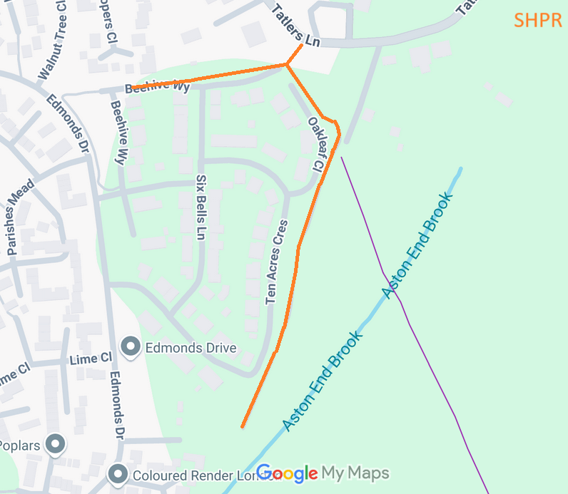
![]() Annotated map reproduced courtesy of Googlemaps. |
This route starts from Beehive Way (public road) and heads eastwards, past a junction with the Stevenage Horse and Pony Route, to Tatlers Lane. Just before tatlers Lane, it turns southeastwards and then southsoutheastwards towards Gresley Way.
The whole of the orange route falls on land owned by Stevenage Borough Council, and which was scheduled as part of the Stevenage Horse and Pony Route. When permission was given for the adjoining houses, this strip was reserved for the non-motorised user (bridleway) route. At the time of the 2024 Access Survey (30 Jun 24), no gates were across the path and it was accessible all the way south to Gresley Way. There were no signposts. |
|
| |||||||
© 2025 Patchetts Green Bridleways Trust. File reference: EC1063.