| Paths Greenways Bridleways Tracks | ||
| PG: OBJECTS: PROMOTION: Tring Town 71 | ||
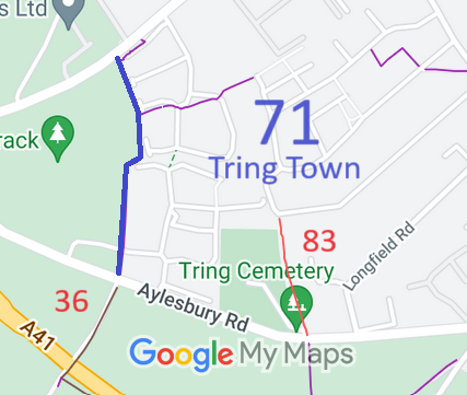
![]() Annotated map reproduced courtesy of Googlemaps. |
This bridleway starts from Aylesbury Road (public road) opposite Tring Town 36 byway and continues generally northwards to end on the Icknield Way (public road).
We need a volunteer to photograph this route for the Access and Riding Rights of Way Survey. It's easy - just take photographs (safely) when you use the path. Find out more! |
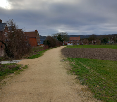
![]() Looking South on Tring Town 71 Photo by kind permission of Hertfordshire County Council, Aug 2024 |
|||
| Legal History 29 Oct 2019: The Tring Town Bridleway 71 Public Path Creation Agreement 2019 made under s.25 Highways Act 1980 upgraded Tring Town 71 Footpath to Bridleway and widened it to 5m. 23 May 2024: The Hertfordshire County Council (Tring Town Bridleway 71) Legal Event Modification Order 2024 added this bridleway to the definitive map and statement. |
Definitive Statement (10 May 2024)
Path: [Tring Town] 71. Status: Bridleway. Definitive Map sheet: 51 Commences at the Aylesbury Road (public road) opposite BOAT 36 at SP 9097 1105 and continued generally N on the W side of the boundary for approx 420m to join Icknield Way (public road) at SP 9096 1144. Width: 5m Limitations: None This is the statement after the effect of the PPCA. |
|
Maintenance
This route is maintainable at the public expense by virtue of s.36(2)(d) Highways Act 1980. [Public Path Creation Agreement] |
© 2024 Patchetts Green Bridleways Trust. File reference: EC1225. HCC reference: DAC/157.