| Paths Greenways Bridleways Tracks | ||
| PG: OBJECTS: PROMOTION: Ware Town 7 | ||
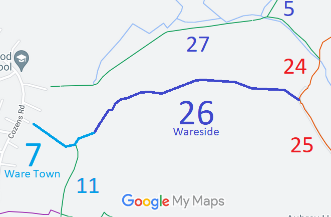
![]() Annotated map reproduced courtesy of Googlemaps. |
Ware Town 7 runs from Cozens Road generally eastwards through a junction with Ware Town 11 bridleway to meet Wareside 26 at the parish boundary.
We need a volunteer to photograph this route for this year's Access and Riding Rights of Way Survey. It's easy - just take photographs (safely) when you use the path. Find out more! |
|||
As part of the British Horse Society's work to record paths before
Path Extinguishment Day,
it was spotted that the historical evidence showed this route carried restricted byway rights and so an application was made in 2018 to amend the definitive map and statement.
| ||||
| Legal History 12 Feb 2018: Application to record as restricted byway. HCC reference EH/463. |
Definitive Statement (4 Dec 2015)
Path: [Ware Town] 7. Status: Bridleway. Definitive Map sheet: 60 Commences from junction with Cozens Road adjacent to maisonettes numbered 126-136, thence SE to junction with BR11 thence NE along Wood Lane to junction with BR26 (Ware Rural) at Town boundary. Reference to Ware Rural parish should now be to Wareside. |
© 2022 Patchetts Green Bridleways Trust. File reference: EC1015. HCC reference EH/463.