
Annotated map reproduced courtesy of Googlemaps.
At the time of the BHS 2021 Access Survey (16 Oct 21), there were no gates across the path and it was signposted at each end. The council signs did not include the 'H25' patch that would have helped H25 followers. There were bollards to make a width restriction at each end, but these would not prevent equestrian access.

1. Sign on Prestwick Road
Photo: Phil Wadey, 16 Oct 2021

2. View from Prestwick Road
Photo: Phil Wadey, 16 Oct 2021

3. Approaching railway arch
Photo: Phil Wadey, 16 Oct 2021

4. Bridge over stream
Photo: Phil Wadey, 16 Oct 2021
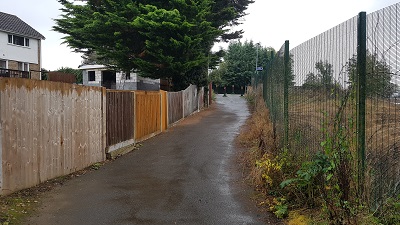
5. Towards Delta Gain
Photo: Phil Wadey, 16 Oct 2021

6. Sign on Delta Gain
Photo: Phil Wadey, 16 Oct 2021

7. View from Delta Gain
Photo: Phil Wadey, 16 Oct 2021
 Back in 1998, this route was just recorded as a footpath. The British Horse Society access officer for Hertsmere sought an upgrade to bridleway in order that the route could carry the H25 London Orbital Bridleroute. Three landowners were identified: Kebbell Holdings Ltd, Network Rail, and Three Rivers District Council. All were approached with a view to dedicating bridleway rights.
Mr Kebbell was first to agree, and his section was dedicated on 11 August 2000. Progress was then slow: the route was able to be used but we were unable to get the authorities to get on with the legal paperwork for the rest of the route. The dedicated path was added to the definitive map only in 2008 after Watford Rural 32 had been added to the map.
The County Council picked things up in 2009 when there was an adjacent planning application. They sorted out the dedications of bridleway status from Network Rail and Three Rivers District Council. Mr Kebbell dedicated extra width for his section too. The full route was added to the definitive map on 20 Jul 2012. It was quite an effort, but all achieved in the end! Well done and thank you to all involved!
