Legal History
2 Feb 1953: The route was recorded as CRB (Carriage Road used as a Bridleway) on the original definitive map and statement. DM sheet DM1-9.
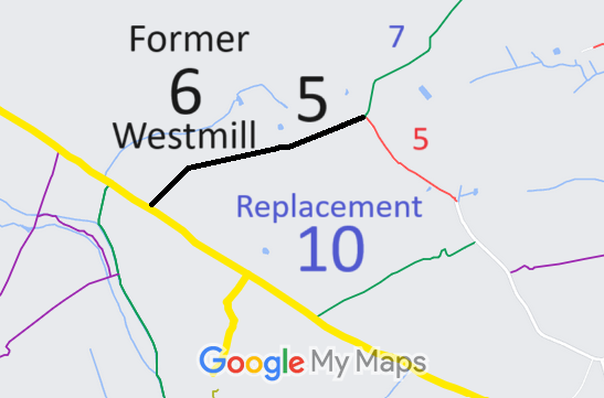
7 Aug 1981: London Gazette notices of intention to ask Magistrates to stop up Westmill 6 and Westmill 5 CRB (part). HCC reference DM1/074.
8 Sep 1981: Petty Sessional Diversion of Hertford and Ware Extinguishment of CRB6 and CRB5 (part) Parish of Westmill Order 1981 stopped up the route and created Westmill 10 bridleway. HCC reference DM1/074.
|
Former Definitive Statement (2 Feb 1953)
Path: [Westmill] 6. Status: CRB.
Definitive Map sheet: Herts XIII SE
Commences at Wakely being a well defined cart track for the initial 100 yards and continuing in the form of a grass track on the northern edge of teh arable field leading direct to Back Lane and teh Parish Boundary.
This path has been stopped up so is no longer shown on the definitive map and statement.
|