Central Bedfordshire Definitive Statement
(19 Jan 2022)
Path: [Hyde] 14. Status: Restricted Byway.
The path is a restricted bwyay. It starts at its junction with Farrs Lane at Ordnance Survey Grid Reference (OS GR) TL 1403 1864 and extends in a general south easterly direction along the western half of Gipsy Lane for approximately 317 metres parallel to and abutting Hertfordshire Restricted Byway No 062 Kimpton to OS GR 1428 1845 and then continues in a generally south south easterly direction for approximately 270 metres to OS GR TL 1437 1821 and then continues in south west and then generally south easterly direction along the western half of the lane in a generally south westerly and then southerly direction 265 metres to terminate at its junction with Wheathampstead Restricted Byway No 005 at the county boundary at OS GR TL1433 1787.
Width: Restricted Byway No 14 Hyde has a variable width of between 2.5 metres and 6 metres between OS GR TL 1404 1864 and OS GR TL 1446 1808 and is the moiety of the width of the lane situated within the county of Bedfordshire as defined by its depiction on the Ordnance Survey 25" :1 mile map (2md Ed) of 1901 for Bedfordshire which has a total width of between 5 metres and 11 metres wide and is indicated by grey shading on the Order map 2.
Hertfordshire Definitive Statement
(19 Jan 2022)
Path: [Kimpton] 62. Status: Restricted Byway.
Definitive Map sheet: 41
Gipsy Lane. Commences from junction with Wheathampstead RB 005 at TL 1468 1808 and runs NW then NE along the county boundary for approx. 175m to TL 1437 1821 and continues NNW for approx. 270m on the NE edge of Rund Wood to TL 1428 1845 and NW for approx. 315m to junction with Farrs Lane (public road) at TL 1403 1865.
Width: Varies between 2.5 and 5 metres between TL 1446 1808 and TL 1403 1865 being the Kimpton moiety of the width of the lane situated within the county of Hertfordshire as defined by its depiction on the Ordnance Survey 25":1 mile map (2nd Ed) of 1901 for Bedfordshire which generally has a total width of between 5m and 11m wide as indicated by grey shading on Order map 2 of the Central Bedfordshire Council (Definitive Map and Statement for Central Bedfordshire)(Hyde Footath No 9, Bridleway No 6 and Resricted Byway No 14) and (Definitive Map and Statement for Hertfordshire)(Kimpton: Restricted Byway No 062) Modificiation Order 2022 .
Limitations: None.
Former Hertfordshire Definitive Statement (4 Dec 2015)
Path: [Wheathampstead] 5. Status: Restricted Byway.
Definitive Map sheet: 41
Commences from Cold Harbour - Kimpton Road NW of Dane Farm thence N to Parish boundary thence N and NE along boundary to Kimpton Parish boundary.
Former Bedfordshire Definitive Statement
Path: [Hyde] 14. Status: Footpath.
The path is a F.P. It starts at County Road 309 follows the route of an agricultural occupation roadway south easterly along the north east side of a spinney and then along the fringe of Round Wood. Then it proceeds to the south west of Great Plumbers Farm to the County Boundary, at a point north of Little Cutts Farm.
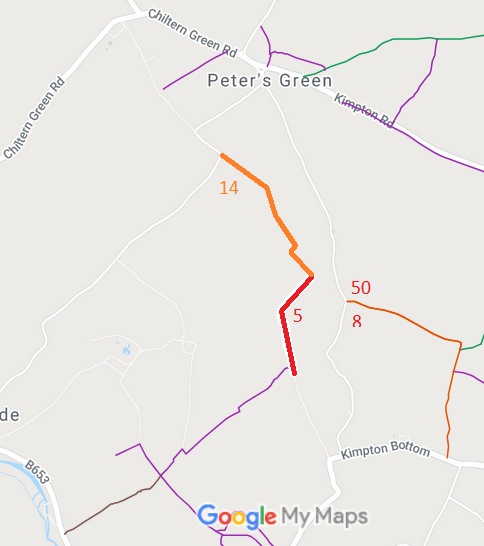
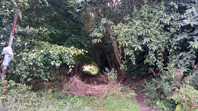
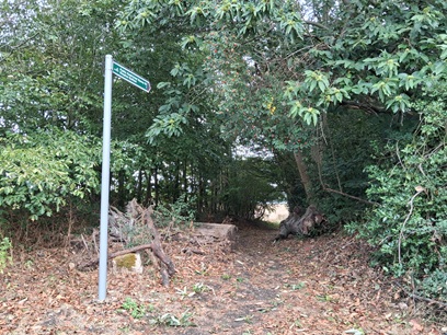
 As part of the British Horse Society's work to record paths before
Path Extinguishment Day,
it was spotted that this county boundary route did not reach Farrs Lane on the definitive map other than as a footpath. It was found that the Trail Riders Fellowship has already applied, in 2002, to Bedfordshire County Council to record the through route with higher rights. Central Bedfordshire Council made a decision to make an order at restricted byway status in 2016. As the route fell partially in Bedfordshire and partially in Hertfordshire, the respective councils had to agree on the content of the order before it could be published. The order was eventually made in 2022 and was unopposed, so was confirmed in 2023.
